Toggle light / dark theme

In 2003, Lyon was just finishing school and working as a hired hacker. Companies tasked him with rooting out vulnerabilities in their systems, and he’d developed mapping tools for the job. His electronic sniffers would trace a network’s lines and nodes and report back what they found. Why not set them loose on the mother of all networks, he thought? So he did.

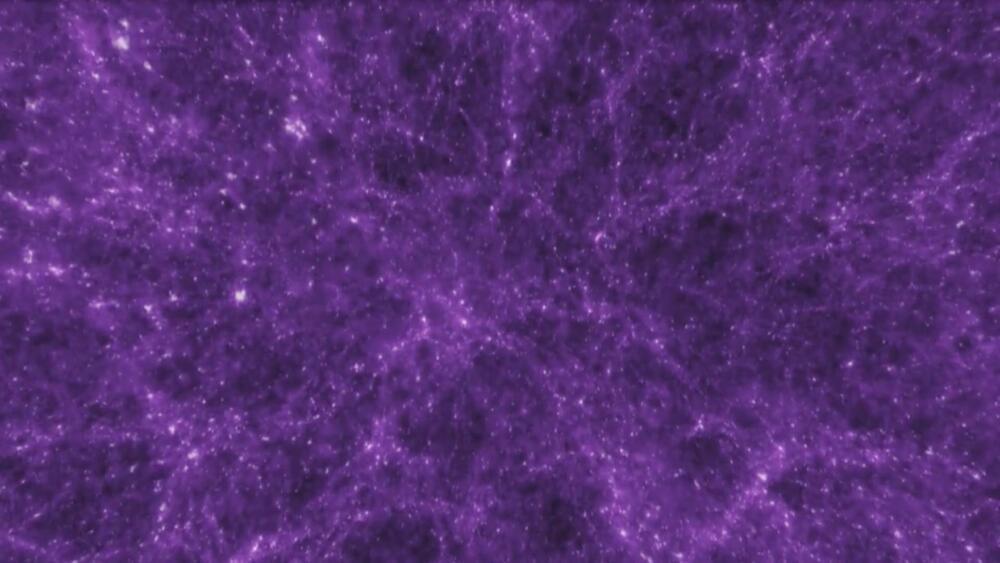
The resulting visualization recalled grand natural patterns, like networks of neurons or the large-scale structure of the universe. But it was at once more mundane and mind-boggling—representing, as it did, both a collection of mostly standard laptop and desktop computers connected to servers in run-of-the-mill office parks and an emerging technological force that was far more than the sum of it parts.

In 2010, Lyon updated his map using a new method. Instead of the traceroutes he used in 2003, which aren’t always accurate, he turned to a more precise mapping tool using route tables generated by the Border Gateway Protocol (BGP), the internet’s main system for efficiently routing information. And now, he’s back with a new map based on BGP routes from the University of Oregon’s Route Views project. Only this time the map moves: It’s a roughly 25-year time-lapse of the internet’s explosive growth.

With an internal global ocean twice the size of Earth’s oceans combined, Jupiter’s moon Europa carries the potential for conditions suitable for life. But the frigid temperatures and the nonstop pummeling of the surface from Jupiter’s radiation make it a tricky target to explore: Mission engineers and scientists must design a spacecraft hardy enough to withstand the radiation yet sensitive enough to gather the science needed to investigate Europa’s environment.

The Europa Clipper orbiter will swoop around Jupiter on an elliptical path, dipping close to the moon on each flyby to conduct detailed reconnaissance. The science includes gathering measurements of the internal ocean, mapping the surface composition and its geology, and hunting for plumes of water vapor that may be venting from the icy crust.

Star clusters are interesting inhabitants of the sky. They vary in sizes, distances, and number of stars, but almost all are spectacular to look at. And most of them are in the process of being torn apart. That is certainly the case for the Hyades star cluster – the closest one to Earth at only 153 light years away. The problem is, there is something causing a lot more destruction than would be expected given the mass and energy in the surrounding space. Now, a team of scientists from ESA have a theory as to what the cause of the destruction might be – a mysterious dark matter sub-halo.

This novel theory extends from findings gleaned from data collected by GAIA, ESA’s star mapping satellite. The GAIA team expected to see what are called “tidal tails” trailing and leading the star cluster as it moves throughout the galaxy. These tails are formed when some stars are forced to the outer edges of the cluster, and then pulled by the gravitational pull of the galaxy itself, pushing some stars forward in their journey through the galaxy, while other stars are pulled further behind.

The GAIA team did find tidal tails on either side of the Hyades cluster when they observed it. However, they were extraordinarily long – thousands of light years across the galaxy, each holding thousands of stars. Observing them in their entirety was only possible because of the GAIA data and a computer model that Dr. Tereza Jerabkova, an ESA research fellow, developed with her colleagues.

Data from ESA’s Gaia star mapping satellite have revealed tantalizing evidence that the nearest star cluster to the Sun is being disrupted by the gravitational influence of a massive but unseen structure in our galaxy.

If true, this might provide evidence for a suspected population of ‘dark matter sub-halos’. These invisible clouds of particles are thought to be relics from the formation of the Milky Way, and are now spread across the galaxy, making up an invisible substructure that exerts a noticeable gravitational influence on anything that drifts too close.

ESA Research Fellow Tereza Jerabkova and colleagues from ESA and the European Southern Observatory made the discovery while studying the way a nearby star cluster is merging into the general background of stars in our galaxy. This discovery was based on Gaia’s Early third Data Release (EDR3) and data from the second release.

The cosmic microwave background, or CMB, is the electromagnetic echo of the Big Bang, radiation that has been traveling through space and time since the very first atoms were born 380000 years after our universe began. Mapping minuscule variations in the CMB tells scientists about how our universe came to be and what it’s made of.

To capture the ancient, cold light from the CMB, researchers use specialized telescopes equipped with ultrasensitive cameras for detecting millimeter-wavelength signals. The next-generation cameras will contain up to 100000 superconducting detectors. Fermilab scientist and University of Chicago Associate Professor Jeff McMahon and his team have developed a new type of metamaterials-based antireflection coating for the silicon lenses used in these cameras.

“There are at least half a dozen projects that would not be possible without these,” McMahon said.

A research team from Skoltech and FBK (Italy) has presented a methodology to derive 4D building models using historical maps and machine learning. The implemented method relies on geometric, neighborhood, and categorical attributes in order to predict building heights. The method is useful for understanding urban phenomena and changes that contributed to defining our cities’ actual shape. The results were published in Applied Sciences.

The researchers conducted a series of government-funded surveys from 2011 to 2020 and located potentially high-yield deposits of various essential industrial minerals from nickel to rare earths, according to a paper published in the Chinese-language Bulletin of Mineralogy, Petrology and Geochemistry last week.


Chinese researchers have spent the last decade mapping the globe’s ocean floors looking for potential mineral deposits.

(Inside Science) — It took years of painstaking work for Carlos Souza and his colleagues to map out every road in the Brazilian Amazon biome. Official maps of the 4.2 million-square-kilometer region only show roads built by federal and local governments. But by carefully tracing lines on satellite images, the researchers concluded in 2016 that the true length of all the roads combined was nearly 13 times higher.

“When we don’t have a good understanding of how much roadless areas we have on the landscape, we probably will misguide any conservation plans for that territory,” said Souza, a geographer at a Brazil-based environmental nonprofit organization called Imazon.

Now, Imazon researchers have built an artificial intelligence algorithm to find such roads automatically. Currently, the algorithm is reaching about 70% accuracy, which rises to 87%-90% with some additional automated processing, said Souza. Analysts then confirm potential roads by examining the satellite images. Souza presented the research last month at a virtual meeting of the American Geophysical Union.