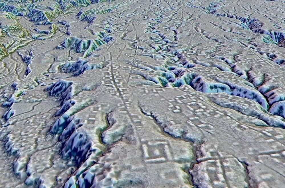
THe cities are over 1,000 years older than any other known Amazonian society.
Over ten years ago, the Dark Energy Survey (DES) began mapping the Universe to find evidence that could help us understand the nature of the mysterious phenomenon known as dark energy.
I’m one of more than 100 contributing scientists that have helped produce the final DES measurement, which has just been released at the 243rd American Astronomical Society meeting in New Orleans.
Dark energy is estimated to make up nearly 70 percent of the observable Universe, yet we still don’t understand what it is. While its nature remains mysterious, the impact of dark energy is felt on grand scales. Its primary effect is to drive the accelerating expansion of the Universe.
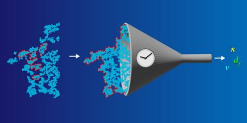
New theoretical work explores the onset of rigidity in granular materials and other disordered systems by mapping out the edges of rigid regions.
Phase transitions are a common part of our daily lives. Many of them are intuitive: water transforms into steam or ice, birds spontaneously form a flock, and random piles of marbles suddenly jam together into a solid. Possibly the most basic phase transition, however, is a more abstract version called connectivity percolation (CP). In systems displaying CP, individual units such as persons or polymers are mapped by their contacts—or connectors—to a graph consisting of nodes and edges. As the number of connectors increases, the system switches from being disconnected (filled with small, separate clusters) to being connected (spanned by one large cluster). This connectivity phase transition is commonly seen in polymer solutions and pandemic spreading, but researchers have also used the percolation perspective to describe the onset of mechanical rigidity in disordered systems, otherwise known as rigidity percolation (RP).
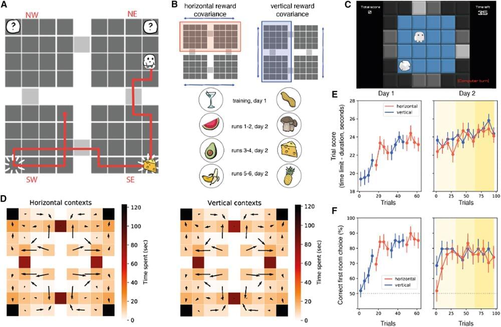
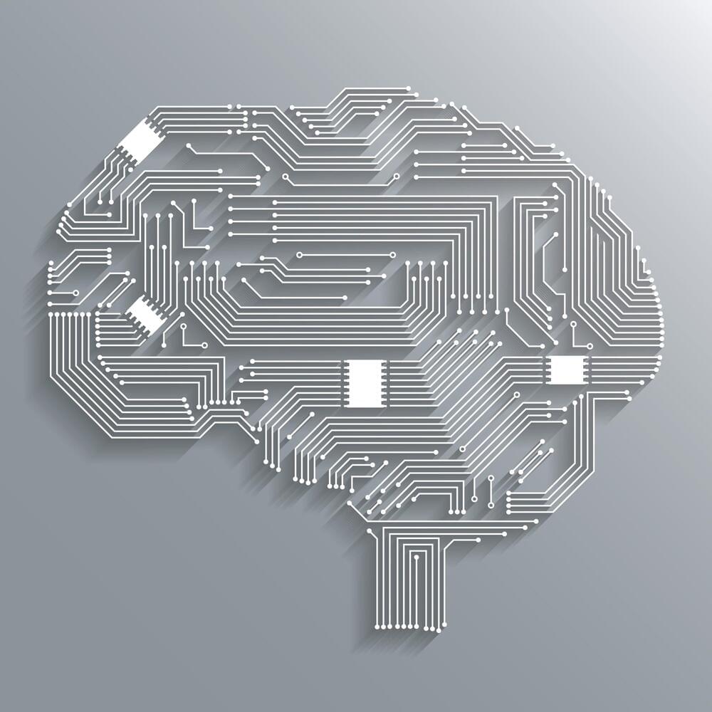
Human decision-making has been the focus of a wide range of research studies. Collectively, these research efforts could help to understand better how people make different types of everyday choices while also shedding light on the neural processes underpinning these choices.
Findings suggest that while making instantaneous decisions, or in other words, choices that need to be made quickly based on the information available at a given moment, humans greatly rely on contextual information. This contextual information can also guide so-called sequential decisions, which entails making a choice after observing the sequential unfolding of a process.
Researchers at the University of Oxford, the National Research Council in Rome, University College London (UCL), and the Max Planck Institute for Human Development recently carried out a study exploring the impact of context on goal-directed decision-making. Their findings, published in Neuron, suggest that goal-seeking ‘compresses’ spatial maps in the hippocampus and orbitofrontal cortices in the brain.
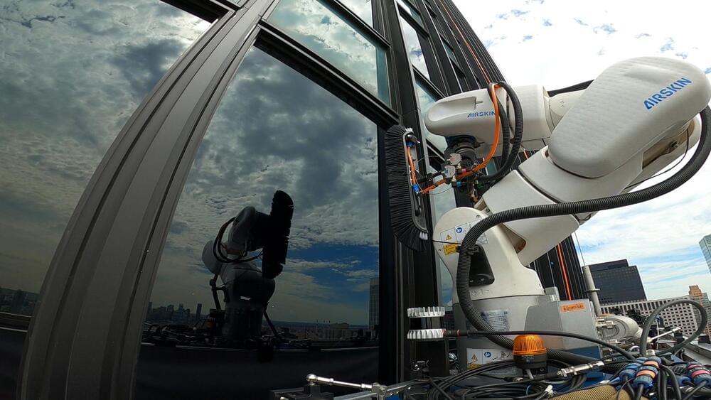
Skyline Robotics is disrupting the century-old practice of window washing with new technology that the startup hopes will redefine a risky industry.
Its window-washing robot, Ozmo, is now operational in Tel Aviv and New York, and has worked on major Manhattan buildings such as 10 Hudson Yards, 383 Madison, 825 3rd Avenue and 7 World Trade Center in partnership with the city’s largest commercial window cleaner Platinum and real estate giant The Durst Organization.
The machine is suspended from the side of a high-rise. A robotic arm with a brush attached to the end cleans the window following instructions from a LiDAR camera, which uses laser technology to map 3D environments. The camera maps the building’s exterior and identifies the parameters of the windows.
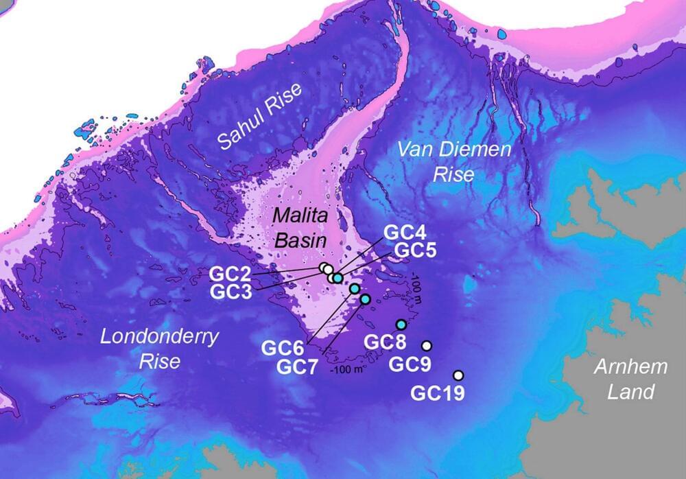
New archaeological research reveals that the sea off northwestern Australia once had islands and a massive landmass. This area was so large it could support around half a million people, as reported in a study published in Quaternary Science Review.
The study maps a world that appeared and then disappeared as sea levels changed over the past seventy thousand years. People are believed to have migrated to this part of the world between forty-five thousand to sixty-five thousand years ago.
The area was part of a paleocontinent called Sahul, connecting Australia to New Guinea. The submersion of this land might have led to significant cultural and population changes in northern Australia.
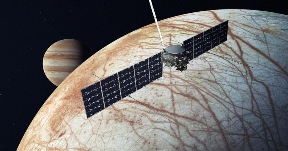
NASA has recently invested in a class of small, low-cost planetary missions called SIMPLEx, which stands for Small, Innovative Missions for PLanetary Exploration. These missions save costs by tagging along on other launches as what is called a rideshare, or secondary payload.
One example is the Lunar Trailblazer. Like VIPER, Lunar Trailblazer will look for water on the moon.
But while VIPER will land on the Moon’s surface, studying a specific area near the south pole in detail, Lunar Trailblazer will orbit the moon, measuring the temperature of the surface and mapping out the locations of water molecules across the globe.
A tool made by grad students is the ultimate “geoguesser,” using its knowledge of Google Street View to track down any photo’s location.
The release of Transformers has marked a significant advancement in the field of Artificial Intelligence (AI) and neural network topologies. Understanding the workings of these complex neural network architectures requires an understanding of transformers. What distinguishes transformers from conventional architectures is the concept of self-attention, which describes a transformer model’s capacity to focus on distinct segments of the input sequence during prediction. Self-attention greatly enhances the performance of transformers in real-world applications, including computer vision and Natural Language Processing (NLP).
In a recent study, researchers have provided a mathematical model that can be used to perceive Transformers as particle systems in interaction. The mathematical framework offers a methodical way to analyze Transformers’ internal operations. In an interacting particle system, the behavior of the individual particles influences that of the other parts, resulting in a complex network of interconnected systems.
The study explores the finding that Transformers can be thought of as flow maps on the space of probability measures. In this sense, transformers generate a mean-field interacting particle system in which every particle, called a token, follows the vector field flow defined by the empirical measure of all particles. The continuity equation governs the evolution of the empirical measure, and the long-term behavior of this system, which is typified by particle clustering, becomes an object of study.