Toggle light / dark theme

Bibliometric Analysis of Global Research on Sugarcane Production and Its Effects on Biodiversity: Trends, Critical Points, and Knowledge Gaps

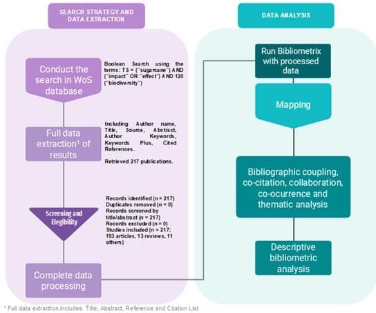
The rising global demand for renewable energy and the urgency of mitigating climate change have positioned biofuels, particularly sugarcane ethanol, at the forefront of sustainability and conservation debates. Although promoted as a renewable alternative, sugarcane cultivation can cause habitat loss, biodiversity decline, soil degradation, and water contamination. This study presents a bibliometric assessment of 217 publications addressing the biodiversity impacts of sugarcane production, based on searches in the Web of Science Core Collection for papers published between 1998 and 2023. Using the bibliometrix package in R, we identified key publication trends, collaboration networks, and thematic structures. Between 1998 and 2006, no studies were returned by our searches, after which research activity increased substantially, peaking in 2021.
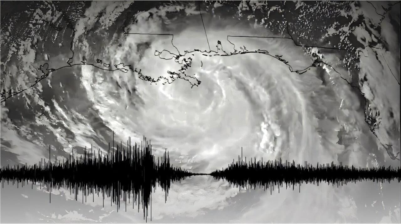
Earthquake sensors can help forecast how hurricanes intensify

Stanford researchers have shown that instruments primarily used to understand earthquakes can capture key details about hurricanes, helping meteorologists better predict how storms will evolve and intensify.

A new study published Aug. 6 in Science demonstrates how specialized microphones and seismometers that detect Earth’s movements can reveal the inner workings of hurricanes. The discovery came after Hurricane Isaac barreled onto the Louisiana coast in 2012, passing over areas where geophysicists had installed sensors for another project.

“We’ve found a new and effective way to gather valuable information about hurricanes from seismic and acoustic sensors,” said lead study author Qing Ji, who conducted the research as a doctoral student in the lab of Eric Dunham at Stanford University. “The geophysics data can provide a fuller understanding of big storms.”

Game-engine forests train drone AI to count trees with far less labeling

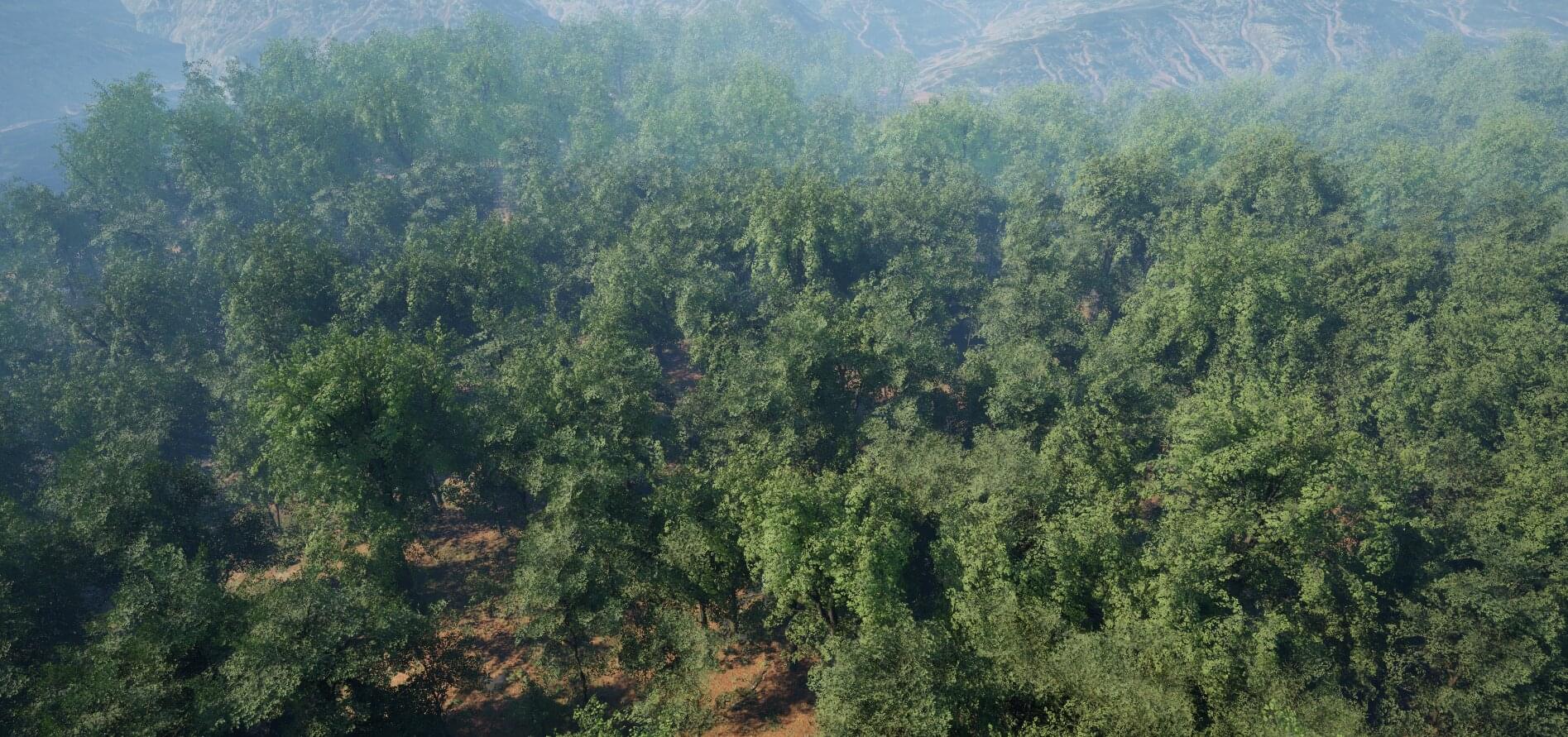
A drone swoops low over an alpine forest. It climbs suddenly to follow the contours of the sharply rising landscape. Pulses from its lidar—a laser mapping instrument—rapidly scan the trees below.

The forest, however, isn’t real. In fact, the entire landscape is a synthetic rendering created by University of Cambridge researchers to teach algorithms how to see trees.

The ability to recognize an individual tree in the forest canopy is essential for calculating how forests grow, how they respond to climate change and how much carbon they store. Until now, researchers developing forest vision systems would painstakingly trace the outlines of thousands of trees to provide the system with sufficient training data, a process that can take weeks.

The oceans near Australia may be the best places to fertilize for removing carbon dioxide

Deploying ocean iron fertilization—a strategy for carbon dioxide capture—in higher latitudes rather than near the equator could reduce environmental impacts while still achieving removal of carbon dioxide from the atmosphere, according to a modeling study published in Nature. The findings offer insight into best practices for maximizing carbon dioxide removal while reducing potential ecological trade-offs typically associated with iron fertilization.

Current carbon emissions are projected to surpass the Paris Climate Agreement’s limit of 2°C above preindustrial levels. Ocean iron fertilization—in which iron is added to surface water to stimulate phytoplankton growth for carbon dioxide removal—is a potential solution. However, the ecological impacts of this strategy, such as creating runaway algal blooms and depleting nutrients in the water, have been a limitation.

Jun Yu, Adam Martiny and colleagues used an ocean iron fertilization model to assess the climate benefits and ecological trade-offs of the approach. By analyzing more than six decades of fertilization data, they found that net carbon dioxide removal was up to 5.3 parts per million, which corresponds to a removal rate of 0.70 gigatons of carbon dioxide per year.

Exploring a smarter way to build climate-resilient roads

Every year from June to September, India experiences the monsoon season. While the visible heavy rainfall often takes the blame for many roads requiring repairs much sooner than expected, a far less visible yet critical force is at play long before the first raindrop falls on the road.

Rigid, or concrete, pavements are a type of road construction that uses concrete slabs. They distribute traffic loads over a wide area and can withstand heavy loads. These pavements are used in places like highways and airports and are becoming increasingly popular on city roads as well.

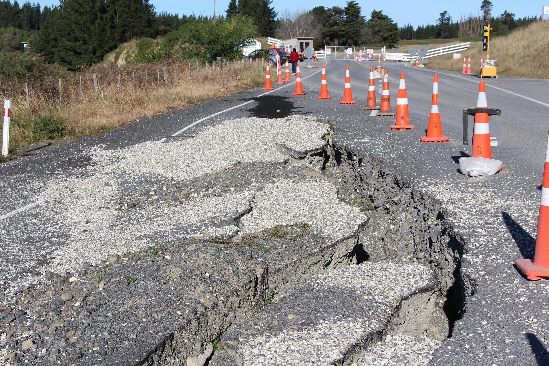
What is interesting is that, together with their surrounding environments, concrete pavements form an integrated system. Daily temperature fluctuations, such as those due to sunlight and cool nights, along with seasonal changes, result in cycles of heating and cooling of the pavement layers. It is these cycles that create internal stresses within the pavement structure.

AI-powered system offers unprecedented insight into the forces shaping Earth’s climate

The world’s oceans may appear calm from space, but beneath the surface, an intricate web of fast-moving currents drives Earth’s climate. Now, a new study led by Tel Aviv University has unveiled a breakthrough that allows scientists to observe these hidden motions with unprecedented clarity.

The researchers developed GOFLOW, an artificial intelligence-powered system that can reconstruct high-resolution ocean current patterns directly from satellite images. The technology provides scientists with an entirely new way to study the small-scale ocean dynamics that influence weather, climate change and the exchange of heat and gases between the ocean and atmosphere.

The study was led by Roy Barkan, a professor, physical oceanographer and fluid dynamics expert in Tel Aviv University’s Department of Geophysics at the Faculty of Exact Sciences. The research was conducted in collaboration with scientists from the Scripps Institution of Oceanography, UCLA and the University of Rhode Island, and published in Nature Geoscience.

Unraveling the climate behind the collapse of Bronze Age civilizations

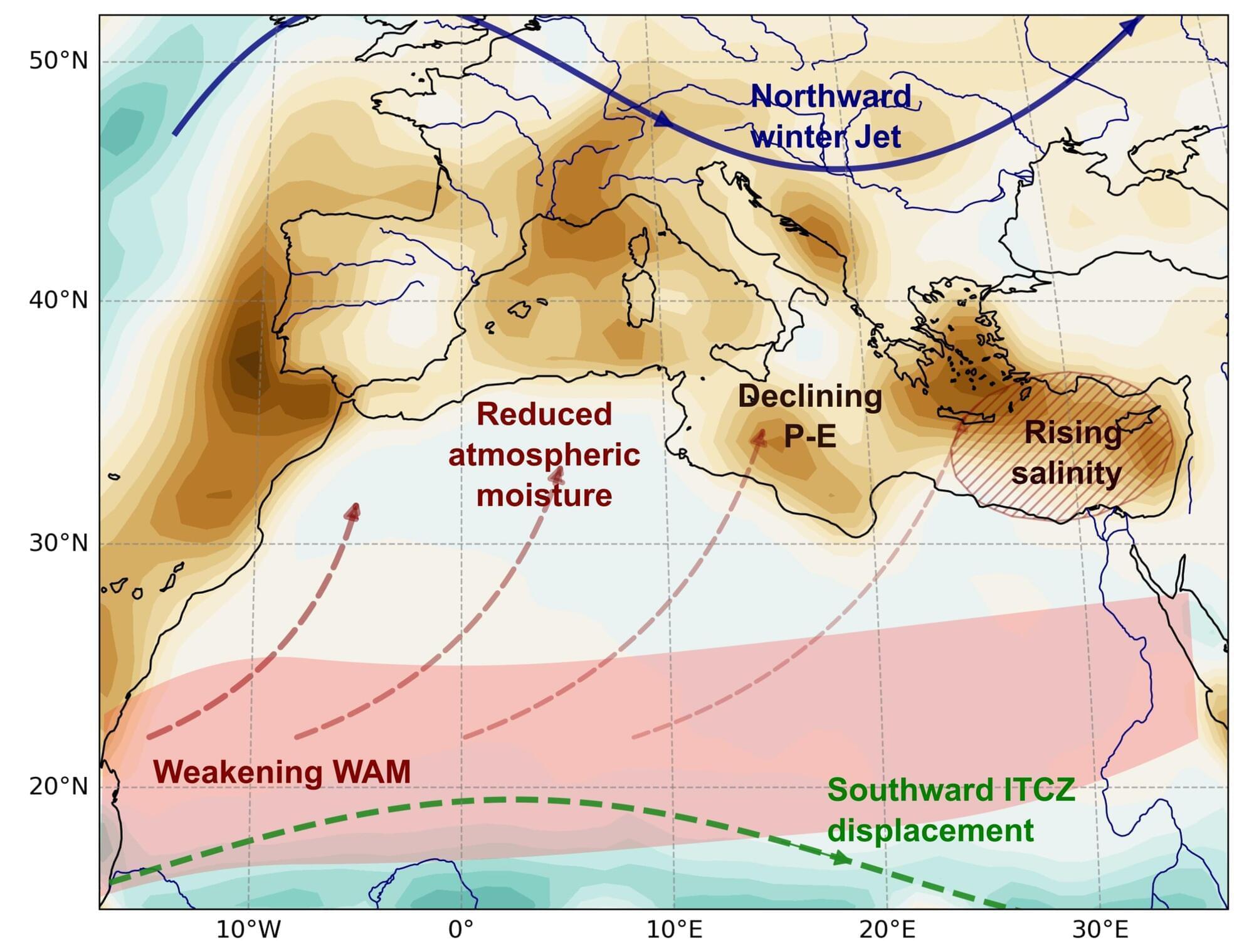
The most severe droughts in the ancient Eastern Mediterranean arose when multiple natural climate cycles coincided, according to a new study from Stockholm University published in Science Advances. The findings shed new light on the climate conditions surrounding the Late Bronze Age collapse and may help improve understanding of future drought risks in a warming world.

“Rather than being caused by a single climatic event, we found that the most extreme droughts emerged when natural climate cycles operating over different timescales coincided. This helps explain why the droughts associated with the Late Bronze Age collapse were so severe,” said Katherine Power, a doctoral student in the Department of Physical Geography at Stockholm University and the study’s first author.

How a pandemic detour helped researchers uncover clues to a mysterious disease

When the COVID-19 pandemic shut down international travel in 2020, Michigan State University researcher Eric Benbow faced a problem. A $2.5 million research project designed to study an environmental pathogen in South America was suddenly on hold. With fieldwork canceled and uncertainty surrounding when travel might resume, Benbow and his collaborators needed a new plan.

That unexpected detour led to a surprising discovery—and new insights into a disease that has puzzled scientists for decades.

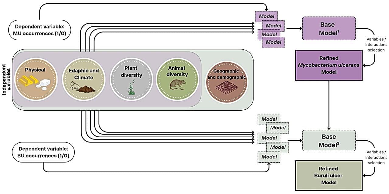
In their study published in Communications Medicine, the international team of researchers examined the environmental and human factors that influence the distribution of Buruli ulcer, a neglected tropical disease caused by the bacterium Mycobacterium ulcerans. The work helps explain how ecosystems, climate, land use and human activities interact to shape disease risk.

Moisture-driven tech can power green batteries—and destroy spy gear

Researchers from North Carolina State University and Rice University have created a nontoxic, stretchable battery that operates by extracting moisture from the ambient environment—even in climates as dry as the desert. The batteries could be useful in Internet of Things (IoT) applications ranging from wearables to advanced surveillance monitors with built-in kill switches. The study is published in the journal Science Advances.

Emerging technologies like wearable monitors, miniature robotics and other IoT devices require lightweight, flexible power sources. Conventional batteries, which represent the best power source options, are often too rigid and heavy to be useful, and they contain toxic materials that can leak. Energy harvesters, so called because they capture energy from the surrounding environment and convert it into electrical power, are lighter, but their performance is limited.

Running on moisture and salt The new moisture-activated battery (MAB) includes a magnesium anode and a silver/silver chloride cathode, with a cellulose membrane loaded with lithium chloride salts that serves as a separator. The separator harvests moisture from ambient air, which dissolves the salts and creates the electrolyte, allowing charge to flow through the battery.

/* */