Menu

Blog

Archive for the ‘hackathon’ tag

May 9, 2020

NASA, partners launch virtual hackathon to develop COVID-19 solutions

Posted by in categories: astronomy, computing, cosmology, engineering, events, hacking, health, information science, innovation, open source, satellites, science, software, space

The U.S. space agency National Aeronautics Space Administration (NASA), European Space Agency (ESA), and Japan Aerospace Exploration Agency (JAXA) are inviting coders, entrepreneurs, scientists, designers, storytellers, makers, builders, artists, and technologists to participate in a virtual hackathon May 30–31 dedicated to putting open data to work in developing solutions to issues related to the COVID-19 pandemic.

During the global Space Apps COVID-19 Challenge, participants from around the world will create virtual teams that – during a 48-hour period – will use Earth observation data to propose solutions to COVID-19-related challenges ranging from studying the coronavirus that causes COVID-19 and its spread to the impact the disease is having on the Earth system. Registration for this challenge opens in mid-May.

“There’s a tremendous need for our collective ingenuity right now,” said Thomas Zurbuchen, associate administrator for NASA’s Science Mission Directorate. “I can’t imagine a more worthy focus than COVID-19 on which to direct the energy and enthusiasm from around the world with the Space Apps Challenge that always generates such amazing solutions.”

The unique capabilities of NASA and its partner space agencies in the areas of science and technology enable them to lend a hand during this global crisis. Since the start of the global outbreak, Earth science specialists from each agency have been exploring ways to use unique Earth observation data to aid understanding of the interplay of the Earth system – on global to local scales – with aspects of the COVID-19 outbreak, including, potentially, our ability to combat it. The hackathon will also examine the human and economic response to the virus.
Continue reading “NASA, partners launch virtual hackathon to develop COVID-19 solutions” »

Apr 22, 2020

Dengue case predictor mapping system wins the 2019 NASA global hackathon

Posted by in categories: astronomy, big data, computing, disruptive technology, environmental, events, hacking, information science, innovation, machine learning, mapping, open source, satellites, science, software, space
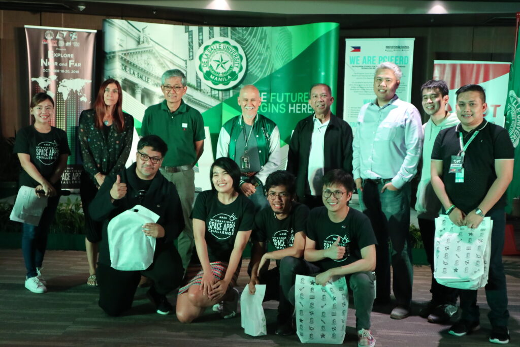
Upper row Associate American Corner librarian Donna Lyn G. Labangon, Space Apps global leader Dr. Paula S. Bontempi, former DICT Usec. Monchito B. Ibrahim, Animo Labs executive director Mr. Federico C. Gonzalez, DOST-PCIEERD deputy executive director Engr. Raul C. Sabularse, PLDT Enterprise Core Business Solutions vice president and head Joseph Ian G. Gendrano, lead organizer Michael Lance M. Domagas, and Animo Labs program manager Junnell E. Guia. Lower row Dominic Vincent D. Ligot, Frances Claire Tayco, Mark Toledo, and Jansen Dumaliang Lopez of Aedes project.

MANILA, Philippines — A dengue case forecasting system using space data made by Philippine developers won the 2019 National Aeronautics and Space Administration’s International Space Apps Challenge. Over 29,000 participating globally in 71 countries, this solution made it as one of the six winners in the best use of data, the solution that best makes space data accessible, or leverages it to a unique application.

Dengue fever is a viral, infectious tropical disease spread primarily by Aedes aegypti female mosquitoes. With 271,480 cases resulting in 1,107 deaths reported from January 1 to August 31, 2019 by the World Health Organization, Dominic Vincent D. Ligot, Mark Toledo, Frances Claire Tayco, and Jansen Dumaliang Lopez from CirroLytix developed a forecasting model of dengue cases using climate and digital data, and pinpointing possible hotspots from satellite data.

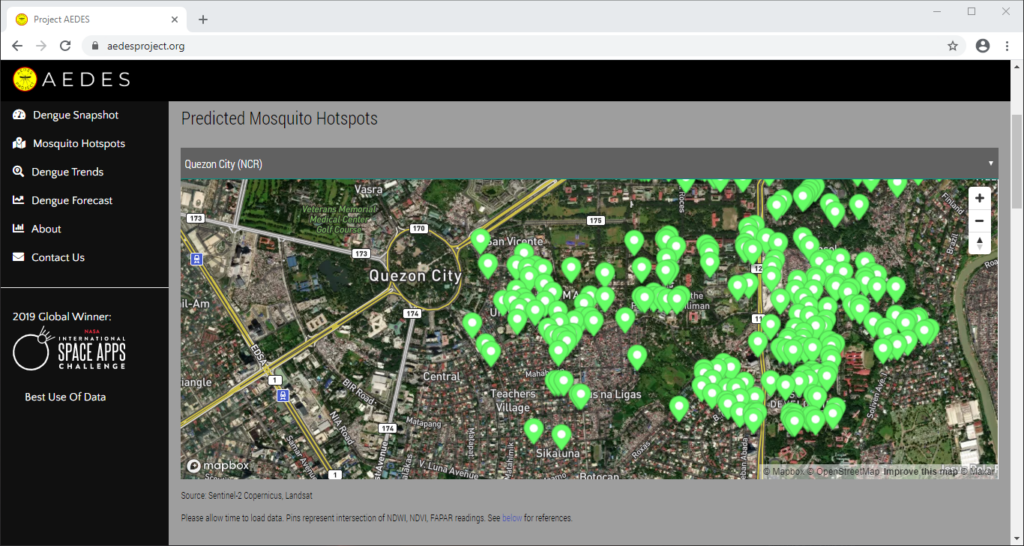
Sentinel-2 Copernicus and Landsat 8 satellite data used to reveal potential dengue hotspots.

Correlating information from Sentinel-2 Copernicus and Landsat 8 satellites, climate data from the Philippine Atmospheric, Geophysical and Astronomical Services Administration of the Department of Science and Technology (DOST-PAGASA) and trends from Google search engines, potential dengue hotspots will be shown in a web interface.

Using satellite spectral bands like green, red, and near-infrared (NIR), indices like Fraction of Absorbed Photosynthetically Active Radiation (FAPAR) and Normalized Difference Vegetation Index (NDVI) are calculated in identifying areas with green vegetation while Normalized Difference Water Index (NDWI) identifies areas with water. Combining these indices reveal potential areas of stagnant water capable of being breeding grounds for mosquitoes, extracted as coordinates through a free and open-source cross-platform desktop geographic information system QGIS.

Check out the website here: http://aedesproject.org/

Winners visit the Philippine Earth Data Resource and Observation (PEDRO) Center at the DOST-Advanced Science and Technology Institute in Diliman, Quezon City with Dr. Joel Joseph S. Marciano, Jr.