Scientists mapping out the quantum characteristics of superconductors—materials that conduct electricity with no energy loss—have entered a new regime. Using newly connected tools named OASIS at the U.S. Department of Energy’s Brookhaven National Laboratory, they’ve uncovered previously inaccessible details of the “phase diagram” of one of the most commonly studied “high-temperature” superconductors. The newly mapped data includes signals of what happens when superconductivity vanishes.
Category: mapping – Page 54
[Editor’s Note: Mad Scientist Laboratory is pleased to publish the following post by returning guest blogger and proclaimed Mad Scientist Ms. Marie Murphy, addressing Directed Energy Weapon (DEW) applications in space, and their potential impact on Multi-Domain Operations (MDO) in the Future Operational Environment.]
The image of the “space war” is ubiquitous from popular Cold War and contemporary renderings: fast attack fighters equipped with laser cannons, swooping in to engage the enemy fleet in an outer space dogfight, culminating with the cataclysmic explosion of the enemy’s dreadnought. The use of directed energy in this scenario, while making for good entertainment, is a far cry from the practical applications of directed energy in space out to 2050. Taking a step back from the thrilling future possibilities of space combat, it is important to note that it is not a question of when lasers will be put into space — they already have been. What is uncertain is the speed at which lasers and other forms of directed energy will be weaponized, and when these capabilities will be used to extend conflict into the physical domain of low-earth orbit and outer space.
Since 2003, NASA has used a laser mounted on a satellite to measure ice sheets and conduct other environmental studies and mapping. This mission involved the constant emission of a green laser, split into six beams, reflecting off polar ice and returning photons to the satellite. NASA is presently exploring the use of lasers for communications, a technology with abundant military applications. One such program, undertaken jointly by NASA and private industry, is the use of optical, or laser, communications between space assets and ground stations on Earth. These optical transmissions have the benefit of allowing the communication.
https://paper.li/e-1437691924#/&h=AT3mdHzXuCejMgVQDYy6JiVw58…e-BeRlnE2g
“Our world is changing so fast… this year we have sessions on artificial intelligence, genetics and what the future holds for our planet. There is a new term now — cli-fi. We have a beautiful session on cli-fi, on what would happen if bees disappear.
”I feel at this moment in our country it is very very important to give impetus to empirical thinking,” the author of ”Paro: Dreams of Passion” said.
Nobel Laureate Venki Ramakrishnan will speak on the ‘Importance of Science’, cosmologist Priyamvada Natarajan on ‘Mapping the Heavens’ and professor of AI Toby Walsh on ‘How the Future is Now’ among others.
Sydney Harbour and the Egyptian pyramids feature in the debut images from the first all-UK radar spacecraft.
NovaSAR was developed jointly by Surrey Satellite Technology Limited of Guildford and Airbus in Portsmouth, and launched to orbit in September.
Its pictures are now being assessed for use in diverse applications, including crop analysis, flood and forestry mapping, and maritime surveillance.
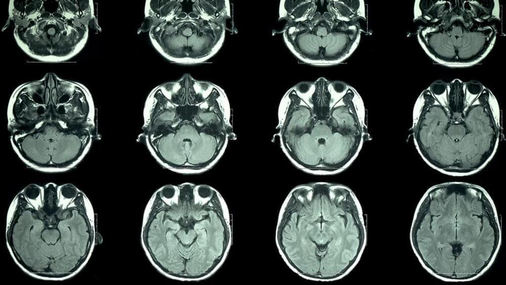
Michio Kaku calls the brain “the most complicated object in the known universe.” So, despite plenty of study, maybe it’s not a total surprise that we’re still finding new parts of it. After decades of mapping the brains of humans and other mammals, and publishing a multitude of books and journal articles on the subject, Professor George Paxinos AO (Order of Australia) has discovered a new region of the human brain that he says could be part of what makes us unique.
Chances are you make it through most days without sparing a thought for Antarctica. At just over 5.4 million square miles, it’s a massive chunk of land that is nearly twice the size of Australia and dwarfs the continental United States. It’s also covered in ice, which makes it a lot less appealing as a potential vacation destination.
Still, it’s of great interest to scientists and researchers, and a new mapping effort has yielded the most stunning, high-resolution glimpse of the continent ever.
Smartphones have disrupted transportation, payments and communication. But the underlying technology has tangentially changed a completely different sector: satellites.
The advances made in miniaturizing technologies that put a computer in your pocket — cameras, batteries, processors, radio antennas — have also made it easier and cheaper for entrepreneurs to launch matter into space. And investors are taking notice.
The chart below shows worldwide venture and PE investment in satellite technology companies.
The Himalayan Range includes some of the youngest and most spectacular mountains on Earth, but the rugged landscape that lends it the striking beauty for which it is known can also keep scientists from fully understanding how these mountains formed. “We know more about the rocks on parts of Mars than we do about some of the areas in the Himalaya,” said Dr. Alka Tripathy-Lang.
“Many researchers have done extraordinary geologic mapping in this rugged region, but the fact is that some places are just completely inaccessible because of topography, elevation, or geopolitical issues. The rocks in those areas are an important piece of the tectonic puzzle and are important for understanding the way the region evolved,” said Dr. Wendy Bohon. “The tools we used, originally developed for mapping rocks on Mars, were a way to safely access information about the rocks in the Himalayas.”
Bohon and colleagues worked with researchers at the Mars Space Flight Facility at Arizona State University to use data from the Earth orbiting satellite Terra in the same way planetary geologists have been using data from the Mars orbiting satellite Odyssey.
- There has been a 14X increase in the number of active AI startups since 2000. Crunchbase, VentureSource, and Sand Hill Econometrics were also used for completing this analysis with AI startups in Crunchbase cross-referenced to venture-backed companies in the VentureSource database. Any venture-backed companies from the Crunchbase list that were identified in the VentureSource database were included.
- The share of jobs requiring AI skills has grown 4.5X since 2013., The growth of the share of US jobs requiring AI skills on the Indeed.com platform was calculated by first identifying AI-related jobs using titles and keywords in descriptions. Job growth is a calculated as a multiple of the share of jobs on the Indeed platform that required AI skills in the U.S. starting in January 2013. The study also calculated the growth of the share of jobs requiring AI skills on the Indeed.com platform, by country. Despite the rapid growth of the Canada and UK. AI job markets, Indeed.com reports they are respectively still 5% and 27% of the absolute size of the US AI job market.
- Machine Learning, Deep Learning and Natural Language Processing (NLP) are the three most in-demand skills on Monster.com. Just two years ago NLP had been predicted to be the most in-demand skill for application developers creating new AI apps. In addition to skills creating AI apps, machine learning techniques, Python, Java, C++, experience with open source development environments, Spark, MATLAB, and Hadoop are the most in-demand skills. Based on an analysis of Monster.com entries as of today, the median salary is $127,000 in the U.S. for Data Scientists, Senior Data Scientists, Artificial Intelligence Consultants and Machine Learning Managers.
- Error rates for image labeling have fallen from 28.5% to below 2.5% since 2010. AI’s inflection point for Object Detection task of the Large Scale Visual Recognition Challenge (LSVRC) Competition occurred in 2014. On this specific test, AI is now more accurate than human These findings are from the competition data from the leaderboards for each LSVRC competition hosted on the ImageNet website.
- Internationally, robot imports have risen from around 100,000 in 2000 to around 250,000 in 2015. The data displayed is the number of industrial robots imported each year into North America and Internationally. Industrial robots are defined by the ISO 8373:2012 standard. International Data Corporation (IDC) expects robotics spending to accelerate over the five-year forecast period, reaching $230.7B in 2021, attaining a Compound Annual Growth Rate (CAGR) of 22.8%.
- Global revenues from AI for enterprise applications is projected to grow from $1.62B in 2018 to $31.2B in 2025 attaining a 52.59% CAGR in the forecast period. Image recognition and tagging, patient data processing, localization and mapping, predictive maintenance, use of algorithms and machine learning to predict and thwart security threats, intelligent recruitment, and HR systems are a few of the many enterprise application use cases predicted to fuel the projected rapid growth of AI in the enterprise. Source: Statista.
- 84% of enterprises believe investing in AI will lead to greater competitive advantages. 75% believe that AI will open up new businesses while also providing competitors new ways to gain access to their markets. 63% believe the pressure to reduce costs will require the use of AI. Source: Statista.
- 87% of current AI adopters said they were using or considering using AI for sales forecasting and for improving e-mail marketing. 61% of all respondents said that they currently used or were planning to use AI for sales forecasting. The following graphic compares adoption rates of current AI adopters versus all respondents. Source: Statista.
Cloud-based, AI-powered location technology is creating the highly accurate and always up-to-date maps that can revolutionize everything from autonomous cars to connected cities. To learn more about the application of data-enriched mapping to industries from retail to automotive, manufacturing, transportation and city planning, don’t miss this VB Live event!
Location is at the heart of everything: it’s the nexus between a device or an individual and the environment they interact with, and it can become the foundation of a smarter society. Location data is powered by cloud capabilities: global maps, traffic information and hundreds of millions of connected devices brought together to create the most up-to-date maps and power the “The Location of Things.”