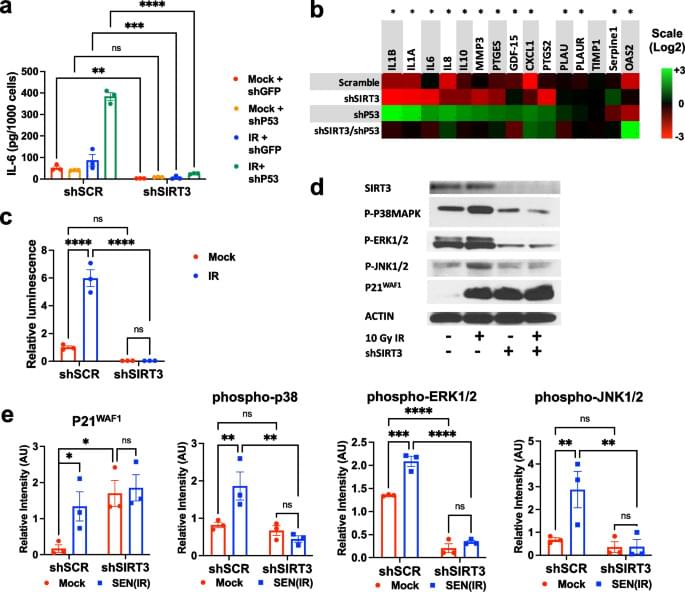
Google is using AI to map the human brain, generate synthetic neurons, and speed up one of the most ambitious neuroscience projects ever attempted. But as brain mapping, connectomics, and AI brain decoding move forward, a terrifying question appears: what happens to mental privacy when machines can understand the brain better than we do?
This mini-documentary explores Google’s brain mapping research, synthetic neurons, AI mind decoding, neural privacy, and the future of human thought in the age of artificial intelligence.
CHAPTERS:
00:00 Google’s Brain Mapping Project.
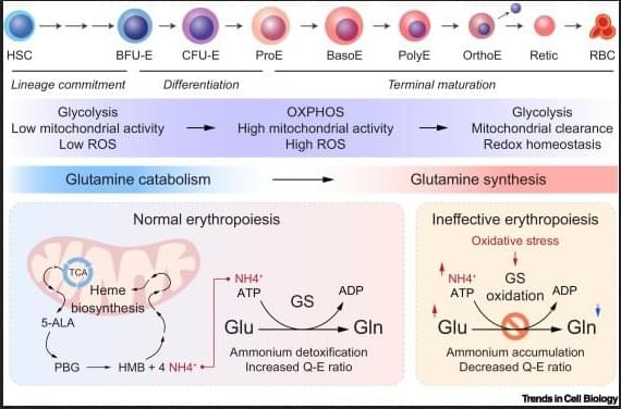
02:00 The Scale of the Human Brain.
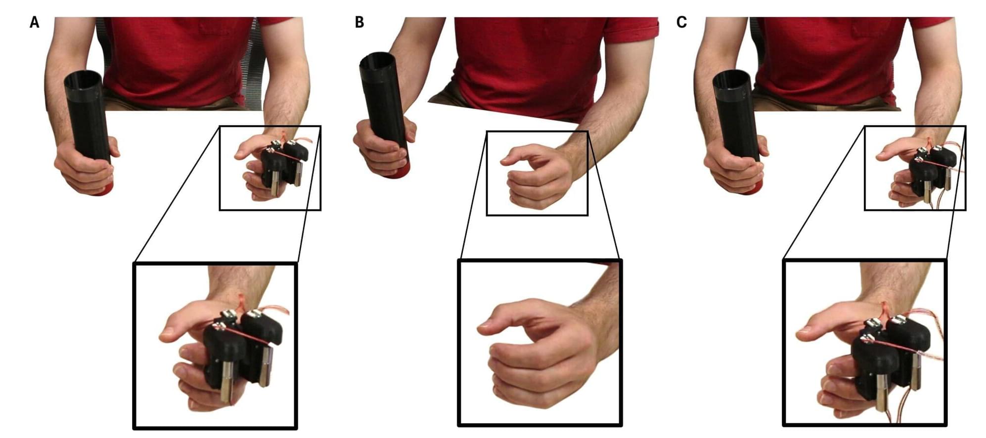
04:36 Synthetic Neurons Explained.
06:40 AI Is Already Decoding Thoughts.
10:15 The Rise of Neural Privacy.
14:51 Brain Maps and the Future of AI
17:11 Who Owns Your Mind?
*******************
🌟 Reverse-Engineer ANY YouTube Channel in Seconds with the World’s First OS for Creators — OverseerOS:
https://www.overseeros.com/
*******************
Welcome to AI Uncovered, your ultimate destination for exploring the fascinating world of artificial intelligence! Our channel delves deep into the latest AI trends and technology, providing insights into cutting-edge AI tools, AI news, and breakthroughs in artificial general intelligence (AGI). We simplify complex concepts, making AI explained in a way that is accessible to everyone.
At AI Uncovered, we’re passionate about uncovering the most captivating stories in AI, including the marvels of ChatGPT and advancements by organizations like OpenAI. Our content spans a wide range of topics, from science news and AI innovations to in-depth discussions on the ethical implications of artificial intelligence. Our mission is to enlighten, inspire, and inform our audience about the rapidly evolving technology landscape.