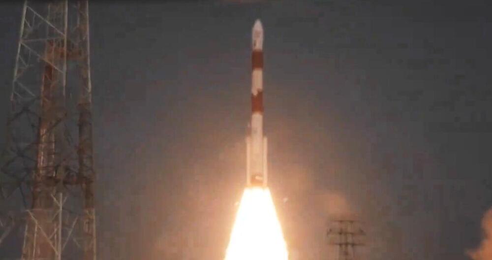
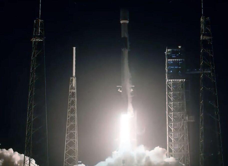
India launched its first satellite on Monday to study black holes as it seeks to deepen its space exploration efforts ahead of an ambitious crewed mission next year.
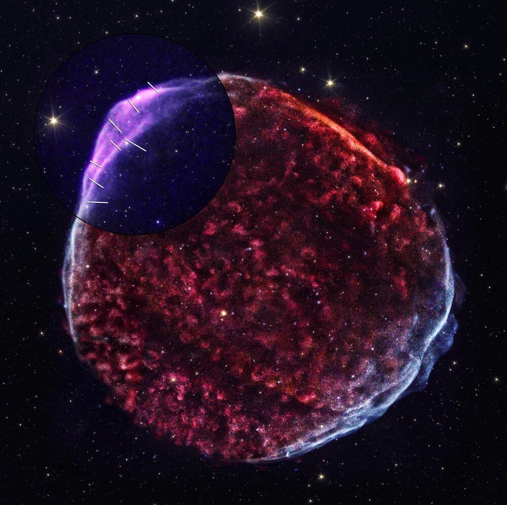
SN 1,006, a supernova observed over a millennium ago, has been extensively studied using NASA ’s Chandra and IXPE telescopes, revealing critical details about its magnetic field and particle acceleration, contributing to our understanding of cosmic rays.
When the object now called SN 1,006 first appeared on May 1, 1006 A.D., it was far brighter than Venus and visible during the daytime for weeks. Astronomers in China, Japan, Europe, and the Arab world all documented this spectacular sight, which was later understood to have been a supernova. With the advent of the Space Age in the 1960s, scientists were able to launch instruments and detectors above Earth’s atmosphere to observe the Universe in wavelengths that are blocked from the ground, including X-rays. The remains of SN 1,006 was one of the faintest X-ray sources detected by the first generation of X-ray satellites.
Recent observations with nasa’s x-ray telescopes.
Recent Gaia satellite findings suggest that dwarf galaxies are transient and less influenced by dark matter than previously believed, challenging long-held assumptions about their nature and composition.
Commonly thought to be long-lived satellites of our galaxy, a new study now finds indications that most dwarf galaxies might in fact be destroyed soon after their entry into the Galactic halo. Thanks to the latest catalog from ESA’s Gaia satellite, an international team has now demonstrated that dwarf galaxies might be out of equilibrium. The study opens important questions on the standard cosmological model, particularly on the prevalence of dark matter in our nearest environment.
It has long been assumed that the dwarf galaxies around the Milky Way are ancient satellites orbiting our Galaxy for nearly 10 billion years. This required them to contain huge amounts of dark matter to protect them from the enormous tidal effects due to the gravitational pull of our galaxy. It was assumed that dark matter caused the large differences observed in the velocities of the stars within these dwarf galaxies.
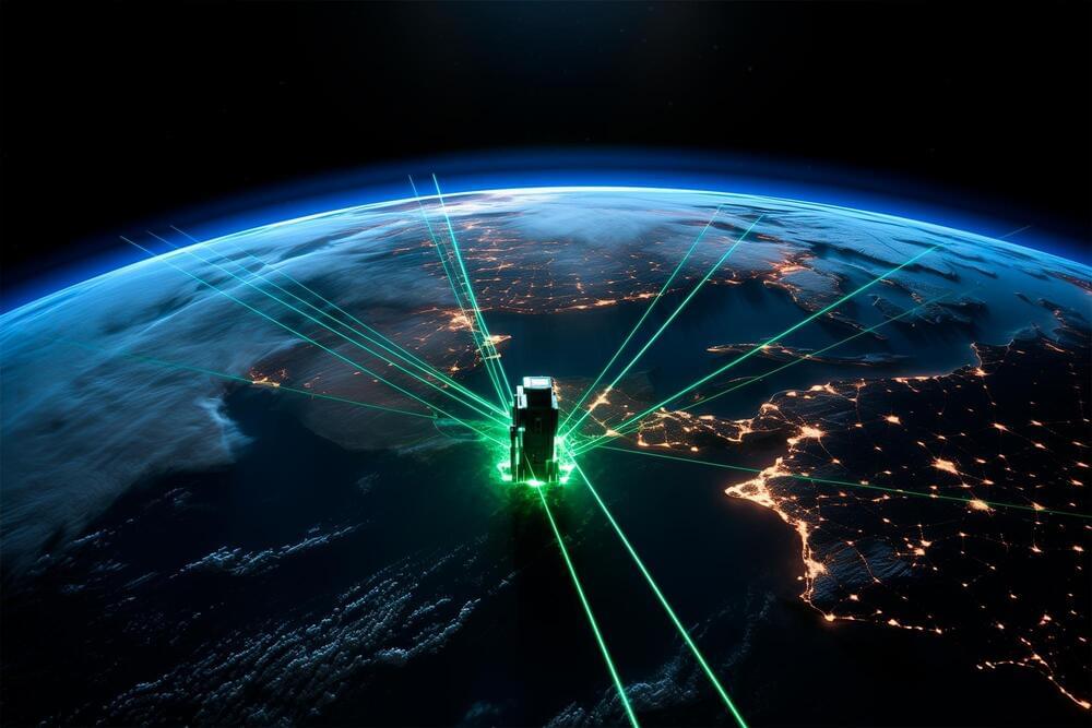
Laser retroreflector arrays (LRAs) are advancing GPS satellite capabilities, crucial for accurate Earth measurements in geodesy. This technology enables precise tracking of Earth’s shape, rotation, and environmental changes.
The best known use of GPS satellites is to help people know their location whether driving a car, navigating a ship or plane, or trekking across remote territory. Another important, but lesser-known, use is to distribute information to other Earth-viewing satellites to help them pinpoint measurements of our planet.
NASA and several other federal agencies, including the U.S. Space Force, U.S. Space Command, the U.S. Naval Research Laboratory, and the National Geospatial-Intelligence Agency are improving the location accuracy of these measurements down to the millimeter with a new set of laser retroreflector arrays, or LRAs.
Even though the guts of General Relativity are obtusely mathematical, and for decades was relegated to math departments rather than proper physics, you get to experience the technological gift of relativity every time you navigate to your favorite restaurant. GPS, the global positioning system, consists of a network of orbiting satellites constantly beaming out precise timing data. Your phone compares those signals to figure out where you are on the Earth. But there is a difference in spacetime between the surface of the Earth and the orbit of the satellites. Without taking general relativity into account, your navigation would simply be incorrect, and you’d be late for dinner.
As revolutions go, general relativity is a big one. And as unifications go, it’s a warning. To make this union happen Einstein had to radically, permanently alter not just our conceptions of gravity as a force acting through space and time, but our conceptions of space and time itself. It took no less than a complete overhaul of our entire philosophical understanding of the relation between space and time to bridge the gap.
And as Einstein would find in the ensuing decades, all the way to the time of his death, that bringing other forces like electromagnetism into the same unified fold would be all but impossible. Electromagnetism, and the other forces, cannot be conceptualized in the same way. Instead we have to use quantum probabilities to make predictions, and when we apply the same technique to gravity we just get infinities.
SpaceX aiming for Saturday launch to deliver German military satellites from West Coast, with sonic booms likely.
WASHINGTON — Space launch provider and satellite manufacturer Rocket Lab has secured a deal worth over half a billion dollars to build 18 satellites for a U.S. government agency.
As disclosed in an SEC regulatory filing Dec. 21, Rocket Lab National Security will “design, manufacture, deliver and operate 18 space vehicles” as part of a U.S. government contract valued at $515 million. A spokesperson said the company could not provide further details.
Sources indicate that the customer is likely the Space Development Agency.
HughesNet’s move to offer 100 Mbps speeds brings it closer to its industry rival, SpaceX’s Starlink, which ranges between 25 to 220 Mbps.
HughesNet’s Jupiter 3 satellite, although geostationary and considerably farther away, rivals Starlink with its size and capacity. The ultra-high-density satellite operates in Ka-band frequencies with 300 spot beams, efficiently allocating and directing signals for better coverage.
Hughes, a pioneer in satellite-delivered internet service since the 1990s, continues to earn recognition.
The company launched 23 of its Starlink internet satellites on a Falcon 9 rocket that had flown 18 times before, breaking its own record for the most flights by a single booster.
SpaceX has achieved a new milestone in its quest to reuse rockets and reduce the cost of spaceflight. The company launched 23 Starlink internet satellites on a Falcon 9 rocket that had flown 18 times before, breaking its record for the most flights by a single booster.
Falcon 9’s first stage has landed on the Just Read the Instructions droneship, completing the first 19th launch and landing of a booster pic.twitter.com/WoVx0R0Esj — SpaceX (@SpaceX) December 23, 2023
The historic launch occurred from Cape Canaveral Space Force Station in Florida on Saturday (December 23) at 12:33 am EST (0533 GMT). The Falcon 9’s first stage, which debuted in May 2020 on the Demo-2 Crew Dragon mission that carried astronauts for the first time, still bore the faded NASA ‘worm’ logo from that occasion.