An international team of astronomers reports the discovery of two new exoplanets, a few times more massive than Earth, orbiting a sun-like star known as HD 35843. The finding was reported in a research paper published May 1 on the arXiv pre-print server.
To date, NASA’s Transiting Exoplanet Survey Satellite (TESS) has identified more than 7,600 candidate exoplanets (TESS Objects of Interest, or TOI), of which 622 have been confirmed by follow-up observations. The satellite’s main aim is to complete a survey of about 200,000 of the nearest brightest stars, searching for transiting exoplanets—from small, rocky worlds to gaseous giants.
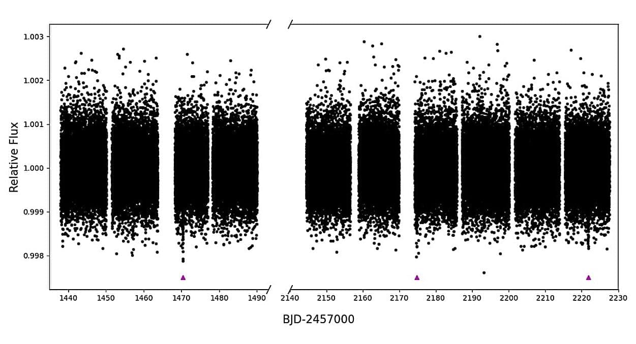
HD 35,843, or TOI 4,189, is a metal-poor G-dwarf star with a radius of approximately 0.9 solar radii and mass comparable to that of the sun. TESS observed this star between 2018 and 2022, which resulted in the detection of a transit signal in its light curve.
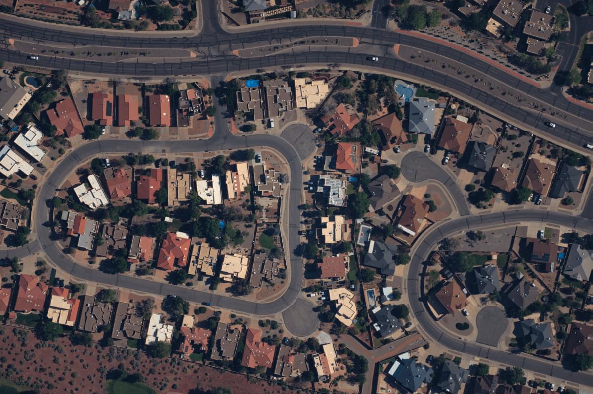
When it comes to creating images of the earth from above, satellites, drones, planes and spacecraft are what tend to come to mind. But a startup called Near Space Labs is taking a very different approach to taking high-resolution photos from up high.
Near Space Labs is building aircraft that are raised by helium balloons and then rely on air currents to stay up, move around to take pictures from the stratosphere, and eventually glide back down to earth. On the back of significant traction with customers using its images, the startup has now raised $20 million to expand its business.
Bold Capital Partners (a VC firm founded by Peter Diamandis of XPRIZE and Singularity University fame), is leading the Series B round. Strategic backer USAA (the U.S. Automobile Association) is also investing alongside Climate Capital, Gaingels, River Park Ventures, and previous backers Crosslink Capital, Third Sphere, Draper Associates, and others that are not being named. Near Space Labs has now raised over $40 million, including a $13 million Series A in 2021.
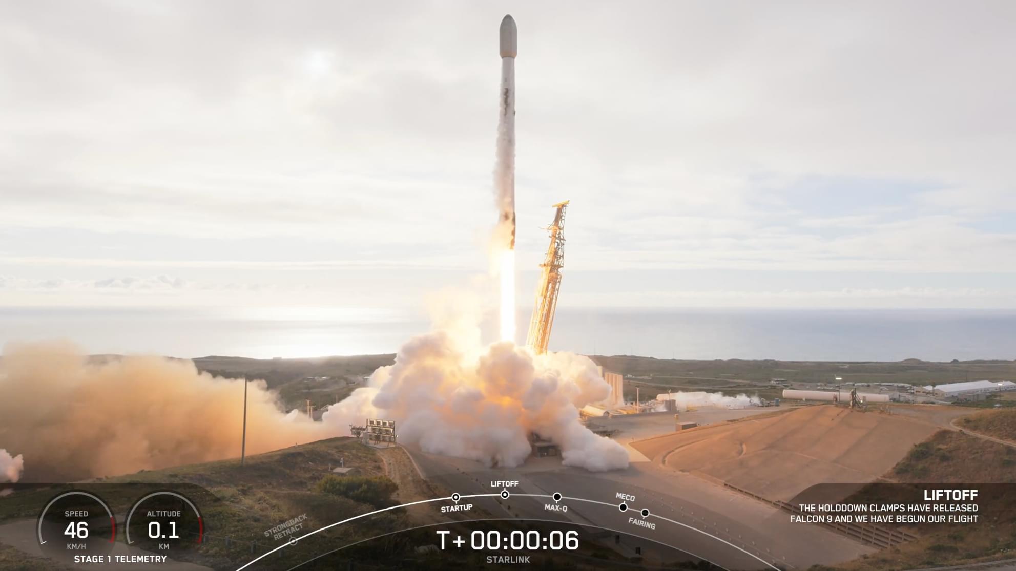
A perfect storm of range restrictions and suboptimal weather seems to finally be clearing for Firefly Aerospace. After delaying the flight of their sixth Alpha rocket for more than a month, the company announced a new launch window, which opens on Sunday.
Onboard the rocket, designated FLTA006 by Firefly Aerospace, is a technology demonstration for Lockheed Martin’s LM400 satellite bus. The mission, dubbed ‘Message in a Booster,’ has its first launch opportunity during a window that runs from 6:37–7:29 a.m. PDT (9:37–10:29 a.m. EDT, 1337–1429 UTC).
That roughly one-hour window is the first opportunity in a five-day stretch approved by the Western Range. Liftoff from Space Launch Complex 2 West (SLC-2W) at Vandenberg Space Force Base is contingent upon good weather and Firefly Aerospace said it will “continue to evaluate wind conditions” as the planned launch day approaches.
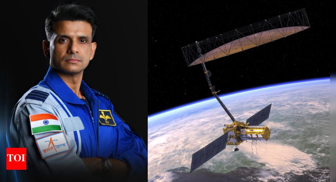
India’s space program is gaining momentum with astronaut Shubhanshu Shukla’s upcoming trip to the ISS as part of the Axiom-4 mission, marking the second Indian in space. Following this, the joint Indo-US NISAR satellite, a significant Earth observation project, is scheduled for launch in June. These missions highlight India’s growing capabilities and international collaborations in space exploration.
Our Vision Weekends are the annual festivals of Foresight Institute. Held in two countries, over two weekends, you are invited to burst your tech silos and plan for flourishing long-term futures. This playlist captures the magic of our Puerto Rico edition, held February 21–23, 2025, in the heart of Old San Juan. Come for the ideas: join the conference, unconference, mentorship hours, curated 1-1s, tech demos, biohacking sessions, prize awards, and much more. Stay for fun with new friends: join the satellite gatherings, solarpunk future salsa night, beach picnic, and surprise island adventures. This year’s main conference track is dedicated to “Paths to Progress”; meaning you will hear 20+ invited presentations from Foresight’s core community highlighting paths to progress in the following areas: Existential Hope Futures, Longevity, Rejuvenation, Cryonics, Neurotech, BCIs & WBEs, Cryptography, Security & AI, Fusion, Energy, Space, and Funding, Innovation, Progress. ══════════════════════════════════════
*About The Foresight Institute*
The Foresight Institute is a research organization and non-profit that supports the beneficial development of high-impact technologies. Since our founding in 1986 on a vision of guiding powerful technologies, we have continued to evolve into a many-armed organization that focuses on several fields of science and technology that are too ambitious for legacy institutions to support. From molecular nanotechnology, to brain-computer interfaces, space exploration, cryptocommerce, and AI, Foresight gathers leading minds to advance research and accelerate progress toward flourishing futures.
*We are entirely funded by your donations. If you enjoy what we do please consider donating through our donation page:* https://foresight.org/donate/
*Visit* https://foresight.org, *subscribe to our channel for more videos or join us here:*