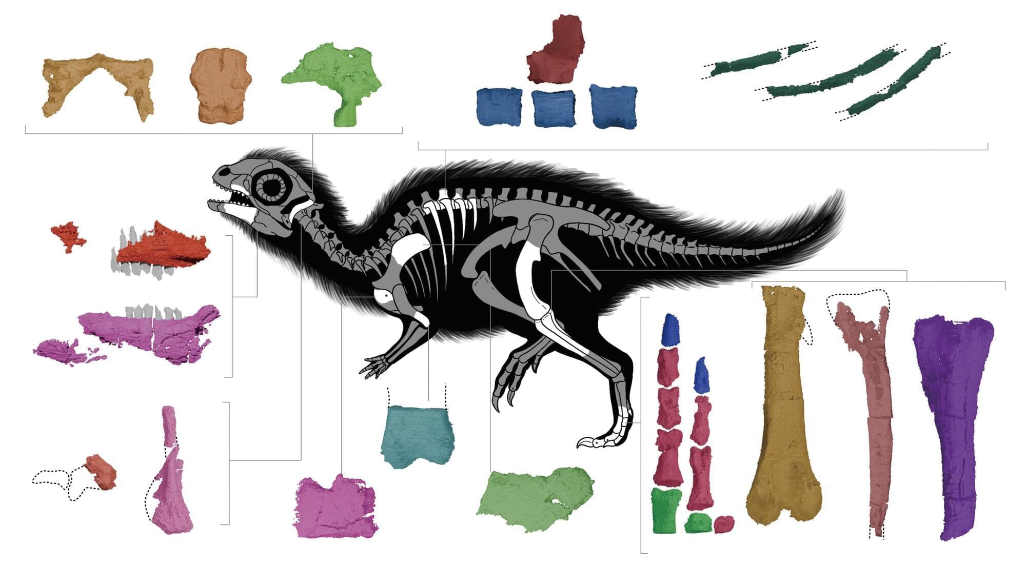
Cute, green, and sporting two sprigs of hair on his head, a mischievous baby dinosaur named Dooly is one of the most beloved cartoon characters in South Korea. So, when researchers from The University of Texas at Austin and the Korean Dinosaur Research Center discovered a new species of baby dinosaur from Korea’s Aphae Island, they knew exactly what to call it: Doolysaurus.
“Dooly is one of the very famous, iconic dinosaur characters in Korea. Every generation in Korea knows this character,” said Jongyun Jung, a visiting postdoctoral researcher at UT’s Jackson School of Geosciences who led the research. “And our specimen is also a juvenile or ‘baby,’ so it’s perfect for our dinosaur species name to honor Dooly.”
The baby dinosaur is the first new dinosaur species discovered in Korea in 15 years and the first Korean dinosaur fossil found with portions of its skull. The skull bones were revealed when the fossil underwent a scientific micro-CT scan at the University of Texas High-Resolution X-ray Computed Tomography (UTCT) facility.