Toggle light / dark theme

DroneSeed will be allowed to operates drones beyond visual line of sight.


DroneSeed, a company that uses fleets of drones to reforest areas burned in wildfires, received approval in October from the Federal Aviation Administration (FAA) for its heavy-lift drones to operate Beyond Visual Line of Sight (BVLOS) and to expand its use of heavy-lift drone swarms to California, Colorado, Montana, Nevada, Arizona and New Mexico.

The FAA’s action allows DroneSeed to begin reforesting once a fire is contained and airspace is clear. Their aircraft drop seeds that are encapsulated in vessels consisting of four to six seeds, fertilizer, natural pest deterrents, and fibrous material which absorbs water and increases survivability.

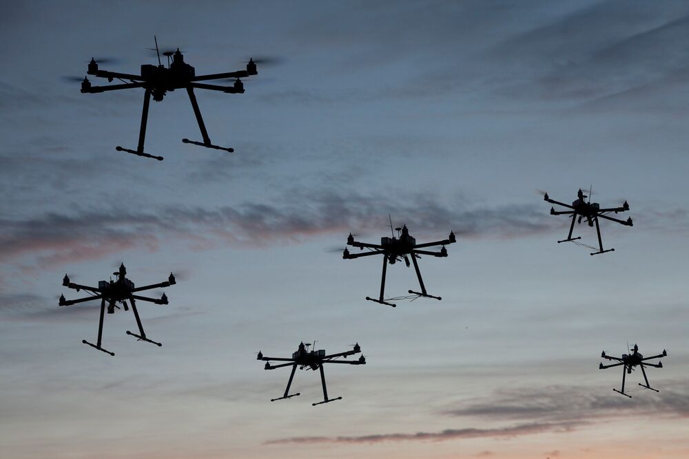
The company has designed a system around a swarm of drones that can drop tree seeds in places where they have a decent chance of survival. First they survey the area with a drone using lidar and a multispectral camera to map the terrain and the vegetation. Software then identifies areas with invasive species or other plants the landowner wants to eliminate that could compete with the new trees. Then a drone can apply herbicide to only the patches that need it, rather than dumping pesticide over the entire landscape. The next step is to use artificial intelligence to sort through the mapping data to find areas where a dropped seed is most likely to germinate, in order to avoid, for example, rock, roads, and unburned locations. After the aircraft is launched, it operates autonomously flying a grid pattern with five drones.

The latest rescue took place last month, when sherriff’s deputies found a missing 93-year-old woman in a dark field in Missouri – using a DJI drone with a thermal imaging camera. That brings the total to more than 500 lives saved by drones, according to DJI’s project counting the lives that would have been lost without direct intervention of drone technology.

DJI began the project back in 2017 when they published a paper called “Lives Saved: A Survey of Drones in Action” which found that even back in 2016 – 2017, drones saved lives at the rate of nearly 1 per week. That first paper has evolved into the DJI Drone Rescue Map, which allows viewers to explore rescue incidents all over the world.

The project was started in response to bad press about drone technology. Research has shown that a negative drone event – even one that later is found to be inaccurate or untrue – averages more than 10x the publicity than a positive drone event. That’s a problem for a new industry struggling against negative public perception and fears over privacy issues and misuse of drone technology.

The Marine Corps is looking for industry sources to produce a man-portable system capable of launching swarms of kamikaze drones over contested battlefields, according to a new notice.

In a request for information published earlier this month, Marine Corps System Command detailed a fresh need for an “individually operated, man-portable, anti-materiel, anti-personnel ground-launched loitering munition system” for fielding to grunts in the coming years.

The so-called Organic Precision Fire-Infantry (OPF-I) capability will consist of a fresh infantry-operated system capable of launching drones that can conduct explosive strikes and are “capable of swarming” over a 20-kilometer range for up to an hour and a half, according to the notice.

It seems some countries are now switching to drone swarms.


From Syria to Libya to Nagorno-Karabakh, this new method of military offense has been brutally effective. We are witnessing a revolution in the history of warfare, one that is causing panic, particularly in Europe.

In an analysis written for the European Council on Foreign Relations, Gustav Gressel, a senior policy fellow, argues that the extensive (and successful) use of military drones by Azerbaijan in its recent conflict with Armenia over Nagorno-Karabakh holds “distinct lessons for how well Europe can defend itself.”

Gressel warns that Europe would be doing itself a disservice if it simply dismissed the Nagorno-Karabakh fighting as “a minor war between poor countries.” In this, Gressel is correct – the military defeat inflicted on Armenia by Azerbaijan was not a fluke, but rather a manifestation of the perfection of the art of drone warfare by Baku’s major ally in the fighting, Turkey. Gressel’s conclusion – that “most of the [European Union’s] armies… would do as miserably as the Armenian Army” when faced by such a threat – is spot on.

A trio of researchers at Johannes Kepler University has used artificial intelligence to improve thermal imaging camera searches of people lost in the woods. In their paper published in the journal Nature Machine Intelligence, David Schedl, Indrajit Kurmi and Oliver Bimber, describe how they applied a deep learning network to the problem of people lost in the woods and how well it worked.

When people become lost in forests, search and rescue experts use helicopters to fly over the area where they are most likely to be found. In addition to simply scanning the ground below, the researchers use binoculars and . It is hoped that such cameras will highlight differences in body temperature of people on the ground versus their surroundings making them easier to spot. Unfortunately, in some instances does not work as intended because of vegetation covering subsoil or the sun heating the trees to a temperature that is similar to the body temperature of the person that is lost. In this new effort, the researchers sought to overcome these problems by using a deep learning application to improve the images that are made.

The solution the team developed involved using an AI application to process multiple images of a given area. They compare it to using AI to process data from multiple radio telescopes. Doing so allows several telescopes to operate as a single large telescope. In like manner, the AI application they used allowed multiple thermal images taken from a helicopter (or drone) to create an image as if it were captured by a with a much larger lens. After processing, the images that were produced had a much higher depth of field—in them the tops of the trees appeared blurred while people on the ground became much more recognizable. To train the AI system, the researchers had to create their own database of images. They used drones to take pictures of volunteers on the ground in a wide variety of positions.

Now more than ever both the importance and limitations of the global delivery infrastructure are on full display. But while Amazon and others try to speed up last mile delivery using drones, Dash Systems hopes to expedite the middle mile — with military-inspired airdrops putting pallets of parcels down at their penultimate destinations, even in the most inaccessible of locations.

Air-based delivery generally consists of four steps. First, an item is taken from the warehouse to the airport. Second, it goes by well-packed large cargo planes from there to another major hub, say from New York to Los Angeles. Third, a truck or smaller plane takes these to their regional destination, a sorting or distribution facility. Fourth, they go out on the familiar delivery trucks and end up on your doorstep.

It’s that third step that Joel Ifill, founder and CEO of Dash, felt could be improved. With an engineering background and experience building guided bombs for the military, he felt that there was an opportunity to apply some of the military’s point-to-point approach to the commercial sector. Why do you need to land at all?