Unmanned aerial vehicles (UAVs), also known as drones, can help humans to tackle a variety of real-world problems; for instance, assisting them during military operations and search and rescue missions, delivering packages or exploring environments that are difficult to access. Conventional UAV designs, however, can have some shortcomings that limit their use in particular settings.
For instance, some UAVs might be unable to land on uneven terrains or pass through particularly narrow gaps, while others might consume too much power or only operate for short amounts of time. This makes them difficult to apply to more complex missions that require reliably moving in changing or unfavorable landscapes.
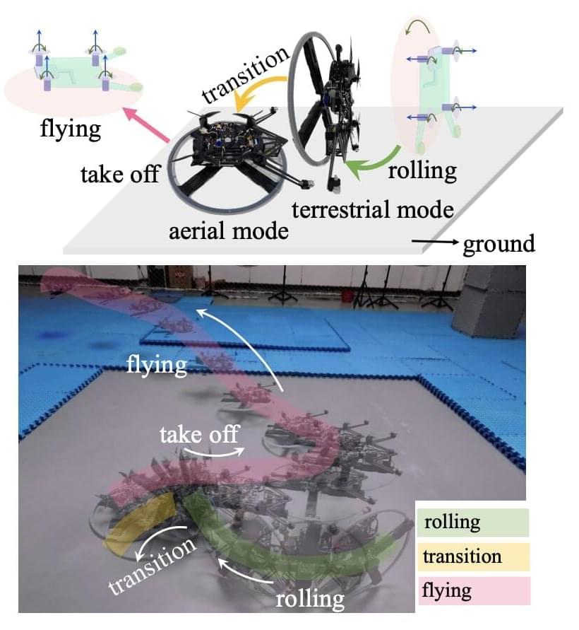
Researchers at Zhejiang University have recently developed a new unmanned, wheeled and hybrid vehicle that can both roll on the ground and fly. This unique system, introduced in a paper pre-published on arXiv, is based on a unicycle design (i.e., a cycling vehicle with a single wheel) and a rotor-assisted turning mechanism.