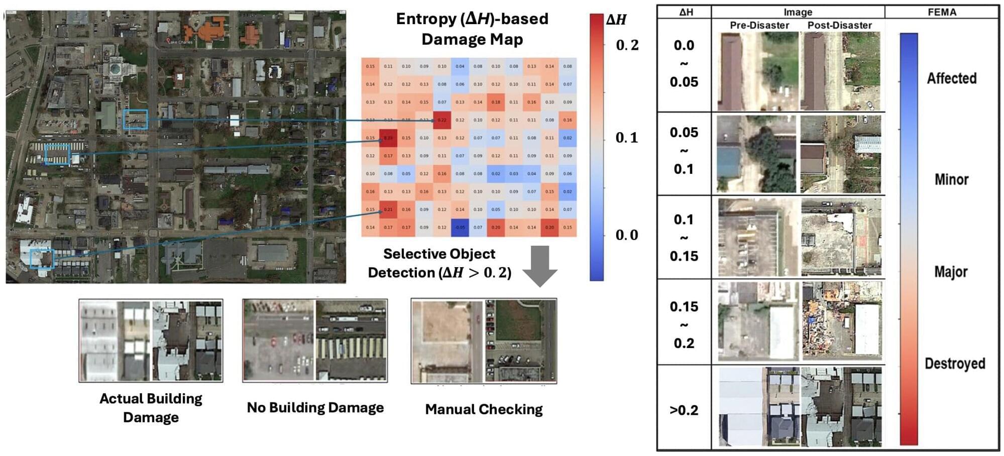
A new technology has been developed that can rapidly predict city-scale structural damage even when portions of satellite imagery are obscured by clouds or smoke immediately after a disaster.
A research team led by professor In Ho Cho of the Department of Architecture at Seoul National University College of Engineering has presented a scientific artificial intelligence (Scientific AI) and data science framework that uses satellite imagery and various forms of open data to rapidly and accurately predict disaster-related structural damage at the city scale. By incorporating a statistical method for correcting incomplete satellite data, the researchers developed an approach that can estimate structural damage immediately after a disaster without requiring a separate, computationally expensive training stage.
The findings are published in Scientific Reports.