Superconductors are one major step closer to practical use thanks to new work from Columbia University physicists.
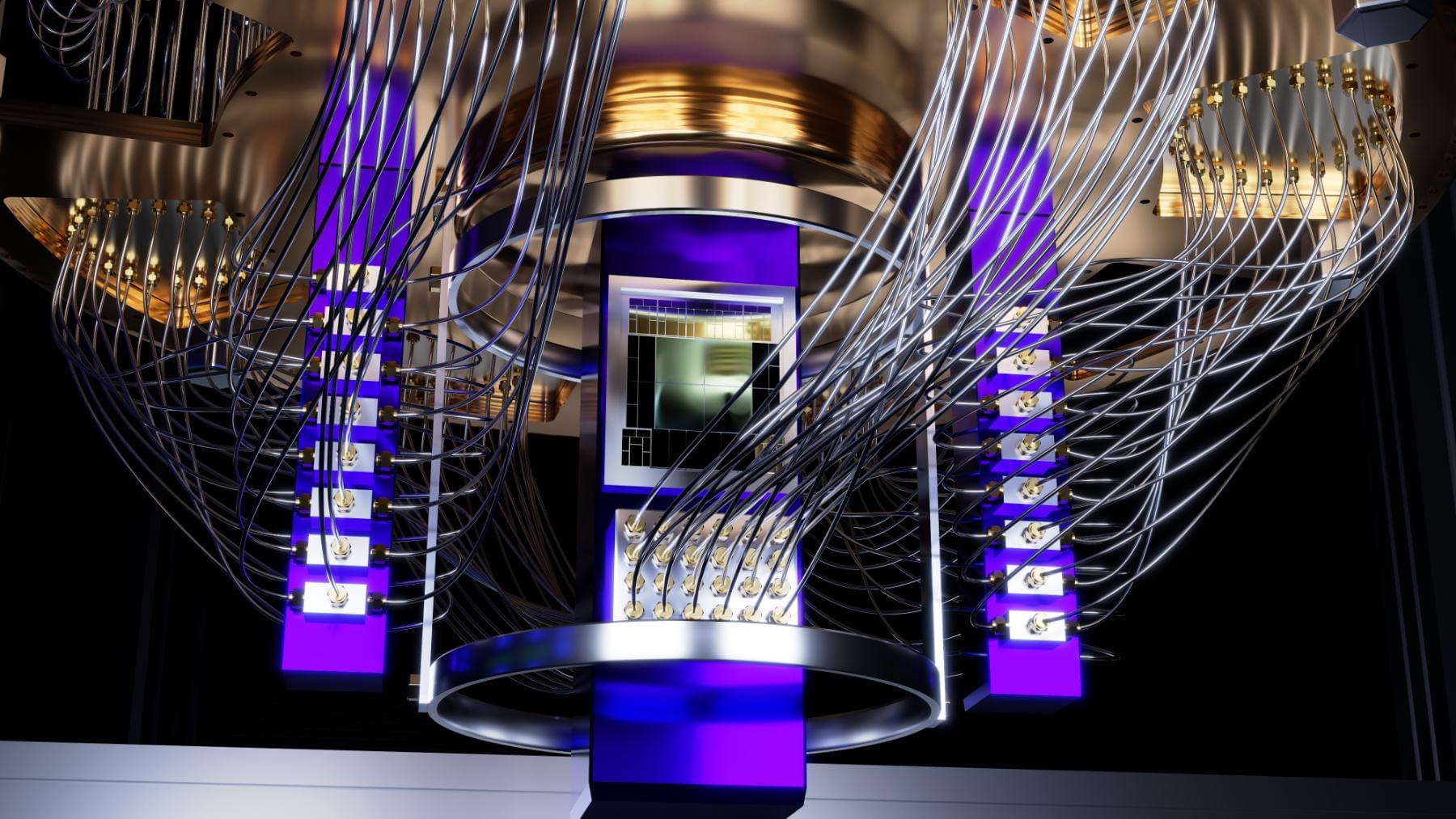
For years, quantum computing has been the tech world’s version of “almost there”. But now, engineers at MIT have pulled off something that might change the game. They’ve made a critical leap in quantum error correction, bringing us one step closer to reliable, real-world quantum computers.
In a traditional computer, everything runs on bits —zeroes and ones that flip on and off like tiny digital switches. Quantum computers, on the other hand, use qubits. These are bizarre little things that can be both 0 and 1 at the same time, thanks to a quantum property called superposition. They’re also capable of entanglement, meaning one qubit can instantly influence another, even at a distance.
All this weirdness gives quantum computers enormous potential power. They could solve problems in seconds that might take today’s fastest supercomputers years. Think of it like having thousands of parallel universes doing your math homework at once. But there’s a catch.
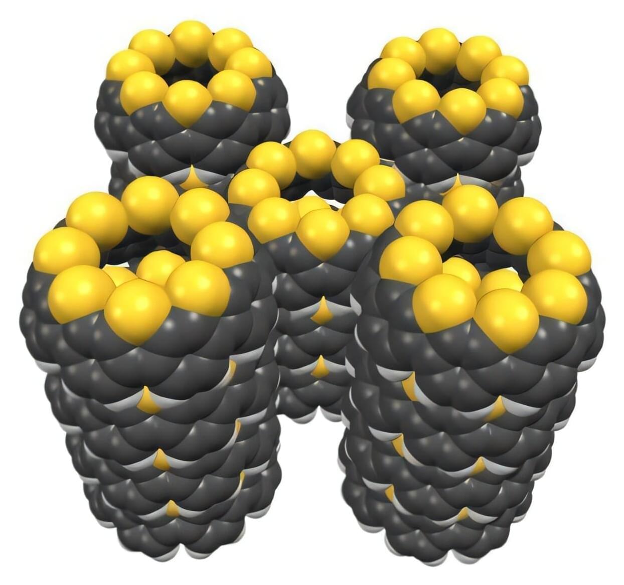
RIKEN chemists have hit upon a fast and easy way to combine so-called nanobelts of carbon with sulfur-containing functional groups. The work is published in the journal Nature Communications.
This new material has intriguing properties that make it promising for use in novel optoelectronic devices.
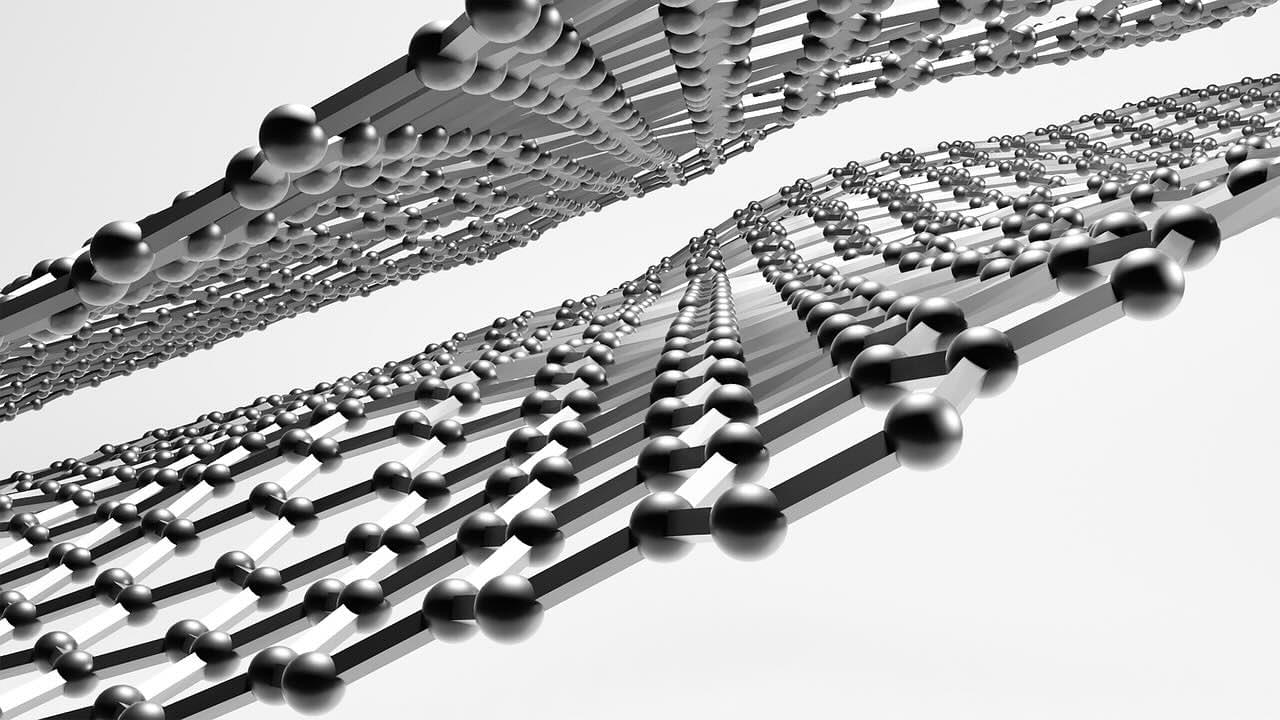
Ever since their discovery in 1991, carbon nanotubes—tiny hollow cylinders made entirely from carbon atoms—have been attracting a lot of interest, being used in applications ranging from electronics to medicine.

Introduction One thing newcomers to machine learning (ML) and many experienced practitioners often don’t realize is that ML doesn’t extrapolate. After training an ML model on compounds with µM potency, people frequently ask why none of the molecules they designed were predicted to have nM potency. If you’re new to drug discovery, 1nM = 0.001µM. A lower potency value is usually better. It’s important to remember that a model can only predict values within the range of the training set. If we’ve trained a model on compounds with IC50s between 5 and 100 µM, the model won’t be able to predict an IC50 of 0.1 µM. I’d like to illustrate this with a simple example. As always, all the code that accompanies this post is available on GitHub.
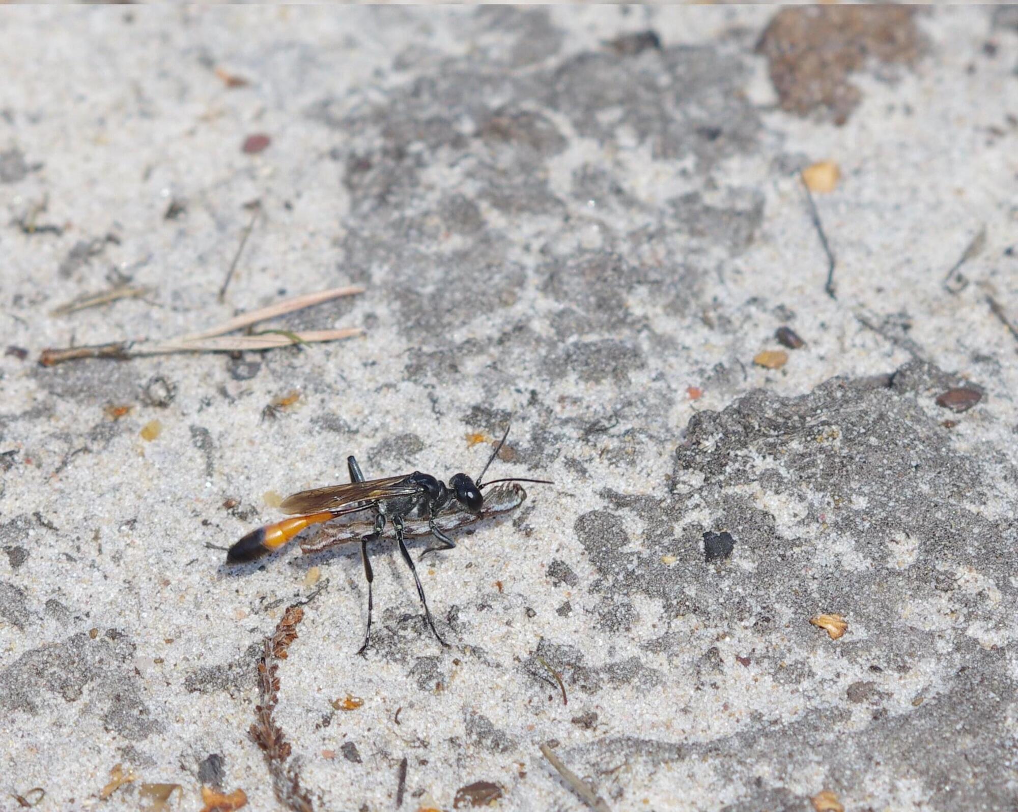
Digger wasps make a short burrow for each egg, stocking it with food and returning a few days later to provide more. A new study reveals that mother wasps can remember the locations of up to nine separate nests at once, rarely making mistakes, despite the fact nests are dug in bare sand containing hundreds belonging to other females.
The paper is published in the journal Current Biology and is titled “Memory and the scheduling of parental care in an insect population in the wild.”
Mothers feed their young in age order, adjusting the order if one dies, and they can even delay feeding offspring that had more food at the first visit. Their intricate scheduling reduces the chance that offspring starve.
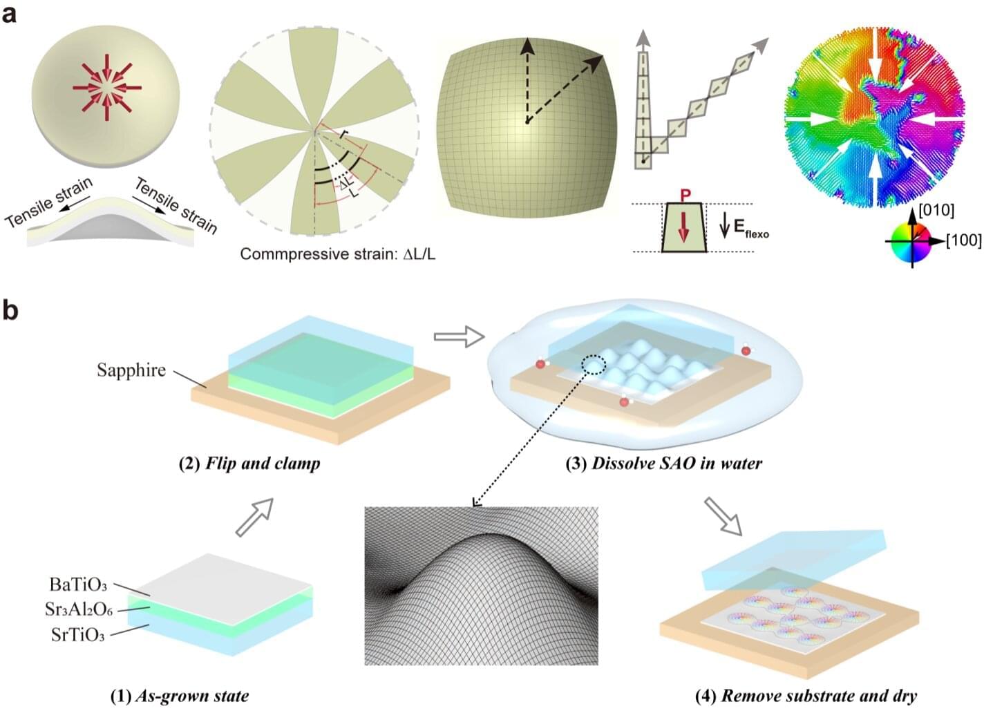
Ferroelectrics are a class of materials that exhibit so-called spontaneous electric polarization, which is the separation of electric charges that can be reversed when an external electric field is applied to them. The dipole moments (i.e., pairs of equal and opposite charges) in these materials can sometimes be arranged in complex configurations known as topological textures.
The topological structures of some ferroelectric materials can interact with light in interesting and unexpected ways, which could have interesting implications for the development of optical technologies and communication systems. The size of ferroelectric polar topologies unveiled and studied to date, however, is not aligned with that of laser light modes, which limited their previous use for the development of optical technologies.
Researchers at Nanjing University recently realized a micrometer-scale center-convergent ferroelectric topology using barium titanate (BaTiO3) membranes that enables the precise spatial control of light fields.
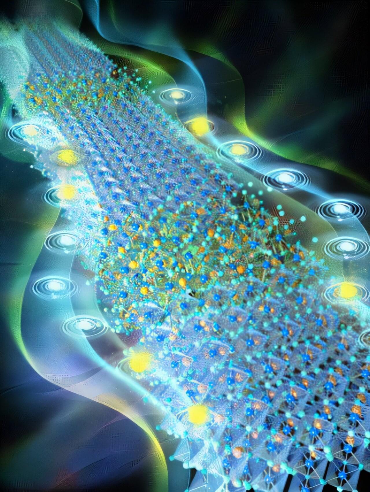
A team from the University of Science and Technology of China (USTC) of the Chinese Academy of Sciences (CAS) has resolved a critical challenge in pure-red perovskite light-emitting diodes (PeLEDs) by identifying and addressing the root cause of efficiency loss at high brightness.
Published in Nature, their study introduces a novel material design that enables record-breaking device performance, achieving a peak external quantum efficiency (EQE) of 24.2% and a maximum luminance of 24,600 cd m-2 —the brightest pure-red PeLED reported to date.
Pure-red PeLEDs, crucial for vivid displays and lighting, have long faced a trade-off between efficiency and brightness. While 3D mixed-halide perovskites like CsPbI3-x Brx offer excellent charge transport, their efficiency plummets under high current due to unresolved carrier leakage.
Tesla is preparing to launch an innovative robo-taxi network in Austin next month, supported by a new affordable Model Y and favorable federal regulations for self-driving vehicles ## ## Questions to inspire discussion ## Tesla’s Robo Taxi Network.
🚗 Q: When and where is Tesla launching its robo taxi network? A: Tesla’s robo taxi network is set to launch in Austin, Texas in June, marking a significant milestone for the company’s self-driving technology.
🤖 Q: How will the robo taxi network impact Tesla’s valuation? A: The successful launch could potentially double Tesla’s stock valuation to over **$1 trillion, validating its unique approach to self-driving vehicles. Cost and Production Advantages.
💰 Q: How does Tesla’s self-driving system compare to competitors in terms of cost? A: Tesla’s AI-based self-driving system is significantly cheaper, with a per-mile cost of $0.10 compared to **$0.50-$1.00 for human-driven rides offered by competitors like Whim and Uber.
🏭 Q: What production advantage does Tesla have over competitors? A: Tesla’s mass production capability of 2 million cars per year gives it a significant advantage over competitors like Whim, which operates with a limited fleet of 1,500 cars. Marketing and Revenue Generation.
📈 Q: How will the robo taxi network benefit Tesla’s marketing efforts? A: The network will serve as a unique marketing channel, allowing customers to experience self-driving rides firsthand, making it easier for Tesla to sell its cars and reach scale.