Milestone accelerates progress toward delivering advanced missile tracking capabilities for the Proliferated Warfighter Space Architecture.
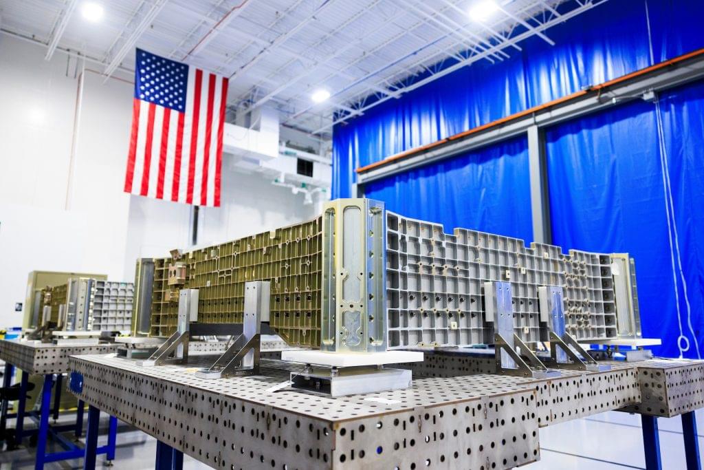
LOUISVILLE, Colo. – January 6, 2026 – Sierra Space, a proven defense-tech company delivering solutions for the nation’s most critical missions and advancing the future of security in space, announced today the completion of the first nine satellite structures, Plane 1 of the 18 total satellites Sierra Space is contracted to deliver for the Space Development Agency’s (SDA) Tranche 2 Tracking Layer (T2TRK) program. Achieved three months ahead of schedule, this milestone underscores Sierra Space’s ability to meet key program milestones with efficiency and precision, helping to ensure that the T2TRK program remains on track for delivery and launch readiness.
“We stood up our high-rate manufacturing facility, Victory Works, to meet the demanding requirements of our customer,” said Erik Daehler, Senior Vice President of Sierra Space Defense. “To go from a successful Critical Design Review to completing the Plane 1 satellite structures—three months ahead of schedule—is a powerful validation of our investment in scalable infrastructure. Our team is energized as we move into the next phase of Plane 1 development, focusing on assembly, integration, and testing, while also beginning the satellite structure build for Plane 2, the remaining nine satellites of the 18-satellite constellation for SDA.”


