I am truly honored and humbled to share this interview with Elon Musk, recorded the same day of the epic and historic launch of Starship IFT-4. #starship #spacex #elonmusk.
Hi! I am now FULL TIME Ellie in SPACE! My channel started as a way to keep people up to date on the world of SpaceX’s Starlink, the satellite internet service. The channel has grown to include the broader Elon Musk universe.
Your support for my channel means a lot. Thanks for watching and if you have any video ideas, shoot me an email, [email protected].
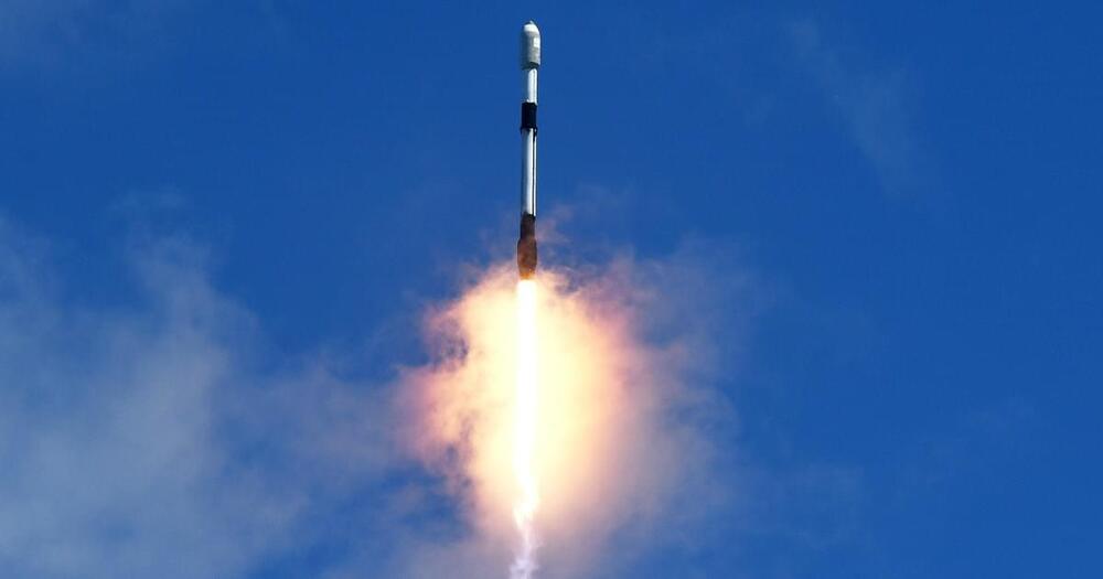
The core mission of this unique satellite is to support reductions in methane emissions around the world.
The satellite will measure atmospheric methane with unprecedented precision and will enable researchers to quantify methane emissions from key emissions regions across the globe.
The research is a partnership be tween the US-based Environmental Defense Fund’s subsidiary LLC and the New Zealand government.
Could autonomous CubeSats someday be used for deep space exploration? This is what a recent demonstration by SpaceX’s Starling swarm of four CubeSats hopes to address as NASA announced the 10-month primary mission of the swarm successfully completed its primary mission objectives as part of multiple experiments. This demonstration holds the potential to help develop CubeSats capable of conducting deep space exploration missions without the need for constant communication with Earth as they could communicate with each other.
“The success of Starling’s initial mission represents a landmark achievement in the development of autonomous networks of small spacecraft,” said Roger Hunter, who is the Program Manager for NASA’s Small Spacecraft Technology Program (STTP) at NASA’s Ames Research Center. “The team has been very successful in achieving our objectives and adapting in the face of challenges.”
For the demonstration, the four CubeSats successfully studied the Earth’s ionosphere while communicating with each other regarding next steps for continued analysis. This provided the opportunity for each spacecraft to equally contribute to the mission while decreasing human involvement.
Scientists “took a picture” of the Big Bang by capturing the cosmic microwave background (CMB) radiation, which is like the afterglow of the Big Bang. They used satellites like the Cosmic Background Explorer (COBE) and the Planck spacecraft to measure this ancient light. These instruments detected faint microwave signals that have been traveling through space for about 13.8 billion years. By analyzing these signals, scientists created a detailed map of the early universe, showing tiny temperature fluctuations. This “picture” helps us understand the universe’s origins and how it has evolved over time. #brightside Credit: Galaxy Cluster Abell: NASA Hubble — https://flic.kr/p/2e8LH2d, CC BY 2.0 https://creativecommons.org/licenses/.…, https://commons.wikimedia.org/wiki/Fi… Cosmic Microwave: ESA and the Planck Collaboration, CC BY 4.0 https://creativecommons.org/licenses/.…, https://commons.wikimedia.org/wiki/Fi… NASA’s Goddard Space Flight Center Animation is created by Bright Side.
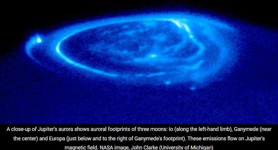
New discoveries about Jupiter could lead to a better understanding of Earth’s own space environment and influence a long-running scientific debate about the solar system’s largest planet. “By exploring a larger space such as Jupiter, we can better understand the fundamental physics governing Earth’s magnetosphere and thereby improve our space weather forecasting,” said Peter Delamere, a professor at the UAF Geophysical Institute and the UAF College of Natural Science and Mathematics.
“We are one big space weather event from losing communication satellites, our power grid assets, or both,” he said.
Space weather refers to disturbances in the Earth’s magnetosphere caused by interactions between the solar wind and the Earth’s magnetic field. These are generally associated with solar storms and the sun’s coronal mass ejections, which can lead to magnetic fluctuations and disruptions in power grids, pipelines and communication systems.
Championing an aerospace renaissance — elizabeth reynolds, managing director, US, starburst aerospace.
Elizabeth Reynolds is Managing Director, US of Starburst Aerospace (https://starburst.aero/), a global Aerospace and Defense (A\&D) startup accelerator and strategic advisory practice championing today’s aerospace renaissance, aligning early-stage technology innovators with government and commercial stakeholders and investors to modernize infrastructure in space, transportation, communications, and intelligence.
Elizabeth’s team works alongside hundreds of technology startups developing new aircraft, spacecraft, satellites, drones, sensors, autonomy, robotics, and much more.
Elizabeth brings 15 years of experience in deep tech entrepreneurship, growth, business operations, and strategy to the team. Prior to joining Starburst, she served as an executive for biotech, medtech, mobility, and interactive media companies, from founding through IPO. She is also an advisor to a number of startups and nonprofits supporting STEM education.
Starburst has offices in Los Angeles, Washington, D.C., Paris, Munich, Singapore, Seoul, Tel Aviv, and Madrid, has grown into a global team of 70 dedicated team members with a portfolio of 140+ startups, 20 accelerator programs, and 2 active venture funds which strive to provide enabling growth services for deep tech leaders disrupting the industry and working towards a safer, greener, and more connected world.
Join our newsletter to get the latest military space news every Tuesday by veteran defense journalist Sandra Erwin.
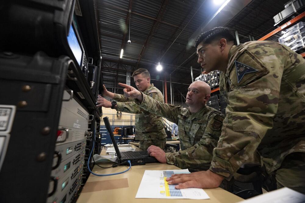
In a statement May 22, the Space Force said this specialized environment will be crucial for training service personnel, known as guardians, to defend critical satellites and other spacecraft from electronic attacks. Satellites rely on electromagnetic signals for communication, navigation, and data transmission, making them vulnerable to jamming and cyberattacks.
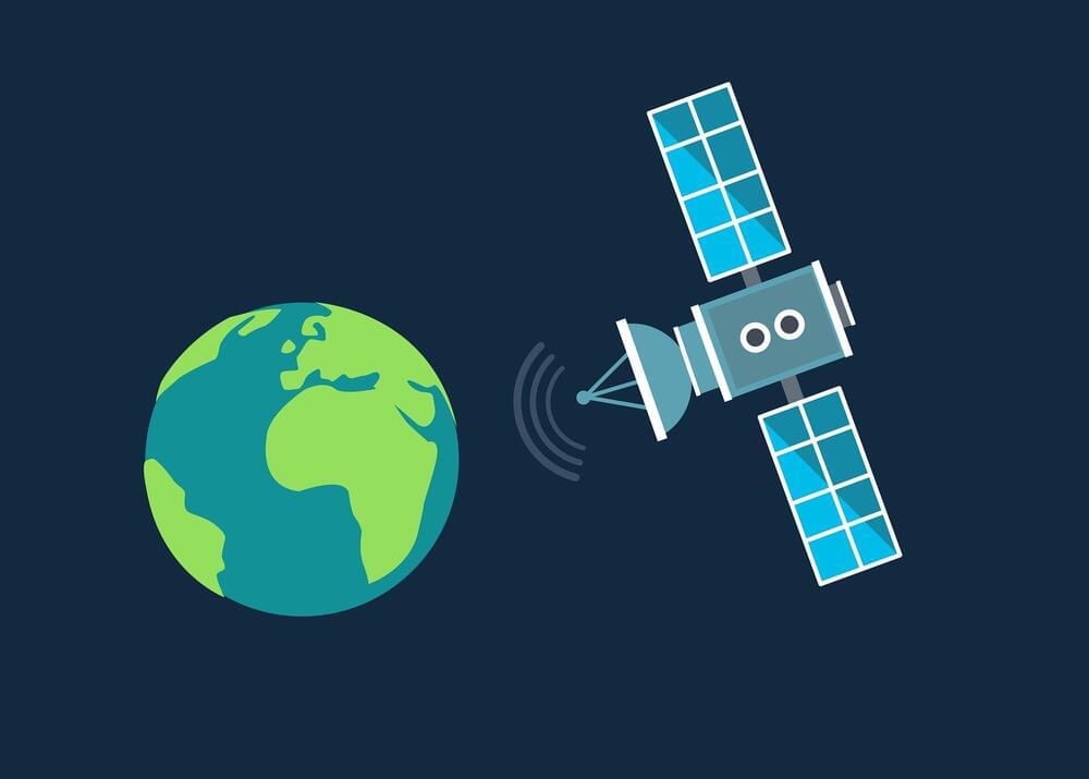
One of the main barriers involves how to connect objects to the internet in places where there is no mobile network infrastructure. The answer seems to lie with low Earth orbit (LEO) satellites, although the solution presents its own challenges.
A new study led by Guillem Boquet and Borja Martínez, two researchers from the Universitat Oberta de Catalunya (UOC) working in the Wireless Networks (WINE) group of the university’s Internet Interdisciplinary Institute (IN3), has examined possible ways to improve the coordination between the billions of connected objects on the surface of the Earth and the satellites in its atmosphere.
The paper is published in the IEEE Internet of Things Journal.