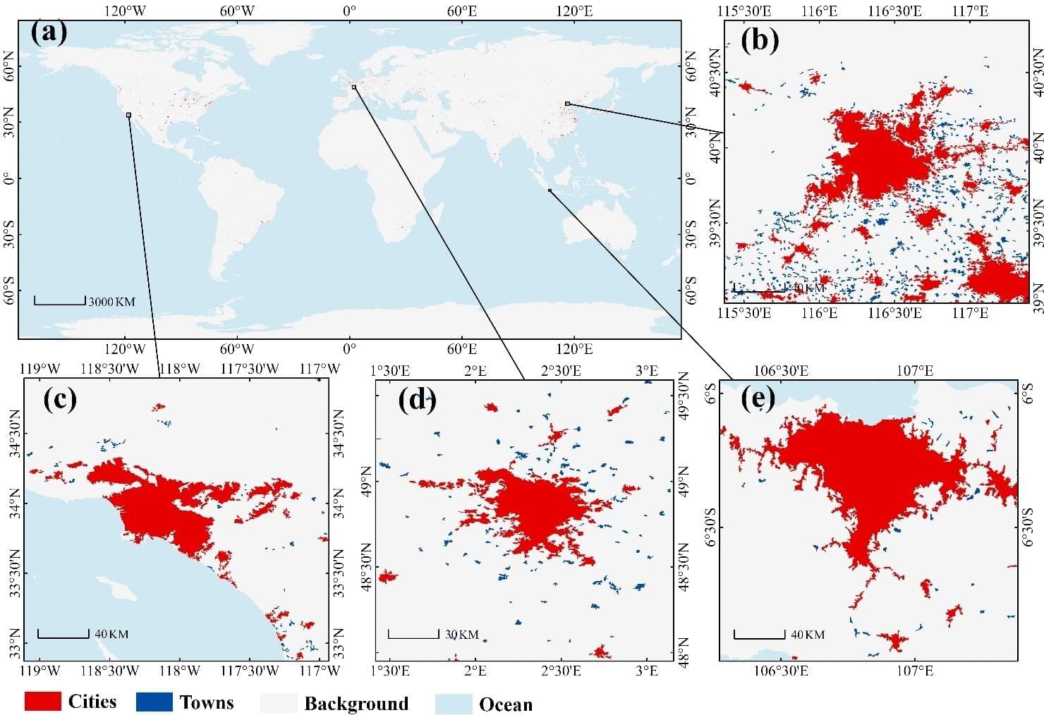
A research team led by Prof. Liu Liangyun from the Aerospace Information Research Institute of the Chinese Academy of Sciences (AIRCAS) has produced the first comprehensive, high-resolution map of global city and town boundaries, offering a view of how urban boundaries have expanded and transformed over the past two decades. The new dataset—derived from 30-meter-resolution satellite observations—fills a long-standing gap in global urban studies.
Cities and towns are the dominant form of human settlement, playing a crucial role in sustaining ecological balance and advancing sustainable development. However, their complex spatial structures and rapid evolution have made high-resolution global urban boundary datasets scarce. To address this gap, the team integrated the GISD30 global impervious surface dynamic dataset with LandScan global population data to develop the Global City and Town Boundaries (GCTB) Dataset, which covers the period from 2000 to 2022.
Published in Scientific Data, the study details the researchers’ development of a morphology-oriented boundary delineation framework that combines kernel density estimation (KDE) and cellular automata (CA) to accurately map urban boundaries. When compared with multiple reference datasets, the GCTB Dataset showed the strongest agreement with the manually curated Atlas of Urban Expansion, achieving an R2 value of approximately 0.88—indicating high reliability in capturing urban extents.