Aviation’s climate impact is partly due to contrails—condensation that a plane streaks across the sky when it flies through icy and humid layers of the atmosphere. Contrails trap heat that radiates from the planet’s surface, and while the magnitude of this impact is uncertain, several studies suggest contrails may be responsible for about half of aviation’s climate impact.
Pilots could conceivably reduce their planes’ climate impact by avoiding contrail-prone regions, similarly to making altitude adjustments to avoid turbulence. But to do so requires knowing where in the sky contrails are likely to form.
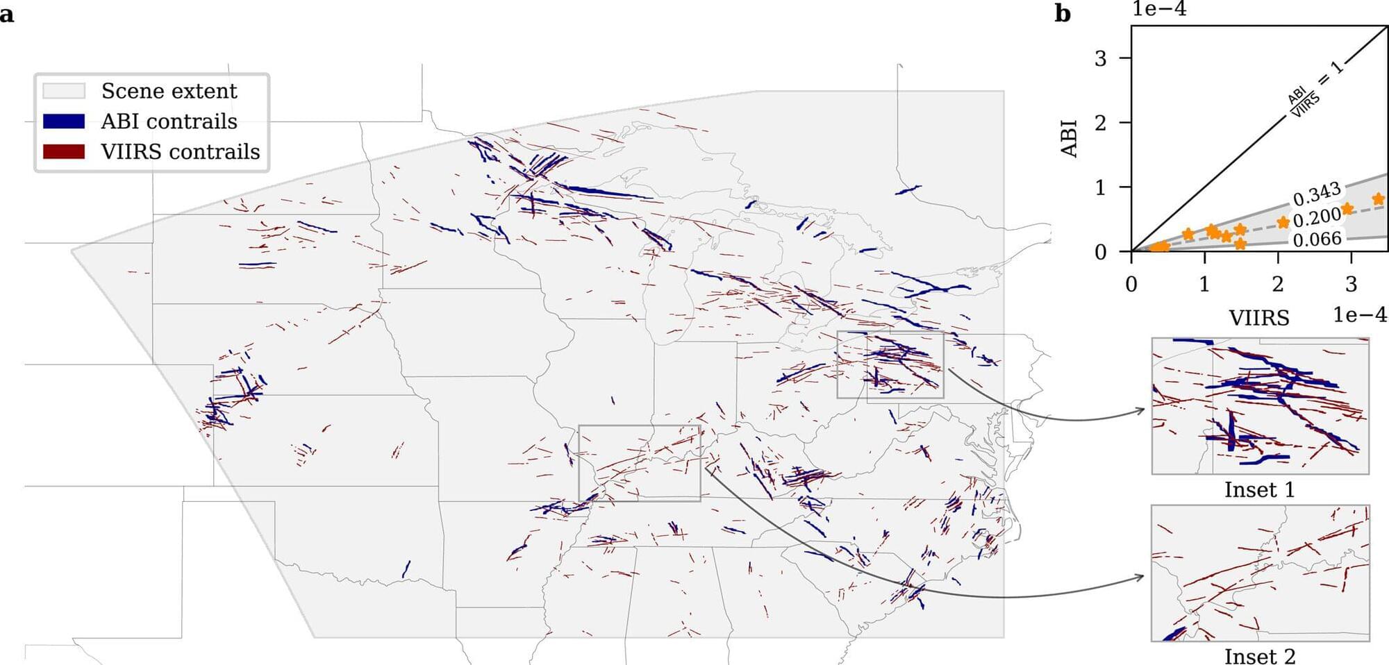
To make these predictions, scientists are studying images of contrails that have formed in the past. Images taken by geostationary satellites are one of the main tools scientists use to develop contrail identification and avoidance systems.