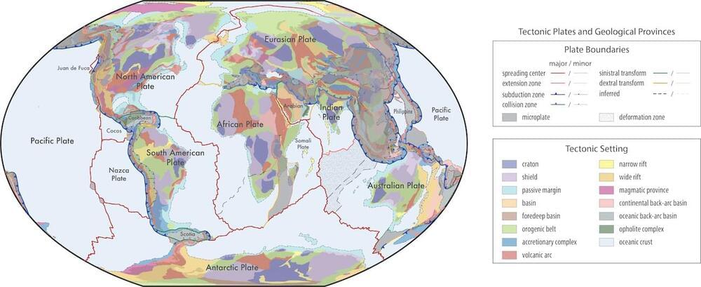
These models are poised to become a standard for classifying geological data across various databases. The models are freely available and open-source, allowing for continual updates and improvements from the geoscience community. This initiative fosters an adaptable and interactive environment, crucial for enhancing our understanding of Earth’s geological history, especially the Mesoproterozoic era and older periods.
A significant innovation is the transition from traditional raster maps to vector format shapefiles. This shift allows for seamless integration of geological data, offering a more nuanced understanding of Earth’s geological fabric. The vector format ensures that each polygon, line, or point can possess multiple unique attributes, enabling a detailed and multidimensional representation of geological features.
In essence, the work paves the way for more precise and comprehensive geological and tectonic models. This is a crucial step towards better predicting and understanding the Earth’s future.
