Color coding makes aerial maps much more easily understood. Through color, we can tell at a glance where there is a road, forest, desert, city, river or lake.
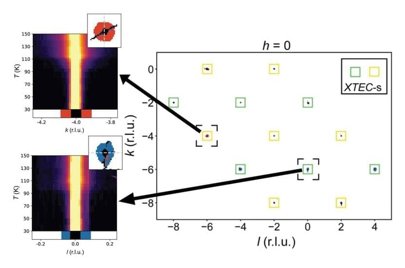
Working with several universities, the U.S. Department of Energy’s (DOE) Argonne National Laboratory has devised a method for creating color-coded graphs of large volumes of data from X-ray analysis. This new tool uses computational data sorting to find clusters related to physical properties, such as an atomic distortion in a crystal structure. It should greatly accelerate future research on structural changes on the atomic scale induced by varying temperature.
The research team published their findings in the Proceedings of the National Academy of Sciences in an article titled “Harnessing interpretable and unsupervised machine learning to address big data from modern X-ray diffraction.”