This is great 💯
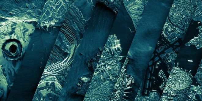
The Finnish space start-up #ICEYE released its rapidly growing archive of tens of thousands of radar satellite images to the public, the company announced in Helsinki today.
The ICEYE archive includes nearly 18,000 #radar images in various modes taken with ICEYE’s SAR satellite constellation between mid-2019 and now, the company said. The images are released for non-commercial use.
“The ICEYE SAR #satellite #constellation is here for the global community of decision makers, data users, and more, to improve our shared world around us all,” said Rafal Modrzewski, CEO and co-founder of ICEYE. “The ICEYE Public Archive opens up a unique view of the world, which we invite you to explore together with us.”
The ICEYE archive is provided as a downloadable file through the ICEYE website, the company said, showing the locations and time of imaging for each thumbnail in the archive. After downloading the file, users can open it with their Geographic Information System (GIS) program of choice, making exploring the world of radar satellite imaging accessible for all.
Luxembourg, 13 October 2020. — The Finnish space start-up ICEYE released its rapidly growing archive of tens of thousands of radar satellite images to the public, the company announced in Helsinki today.