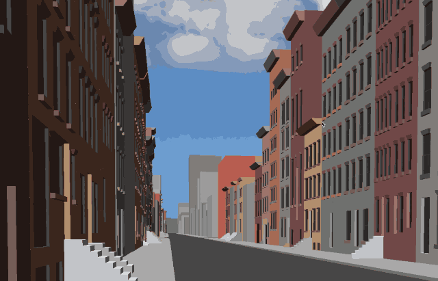
Head Image Caption: Street level view of 3D-reconstructed Chelsea, Manhattan
Historians and nostalgic residents alike take an interest in how cities were constructed and how they developed — and now there’s a tool for that. Google AI recently launched the open-source browser-based toolset “rǝ,” which was created to enable the exploration of city transitions from 1800 to 2000 virtually in a three-dimensional view.
Google AI says the name rǝ is pronounced as “re-turn” and derives its meaning from “reconstruction, research, recreation and remembering.” This scalable system runs on Google Cloud and Kubernetes and reconstructs cities from historical maps and photos.