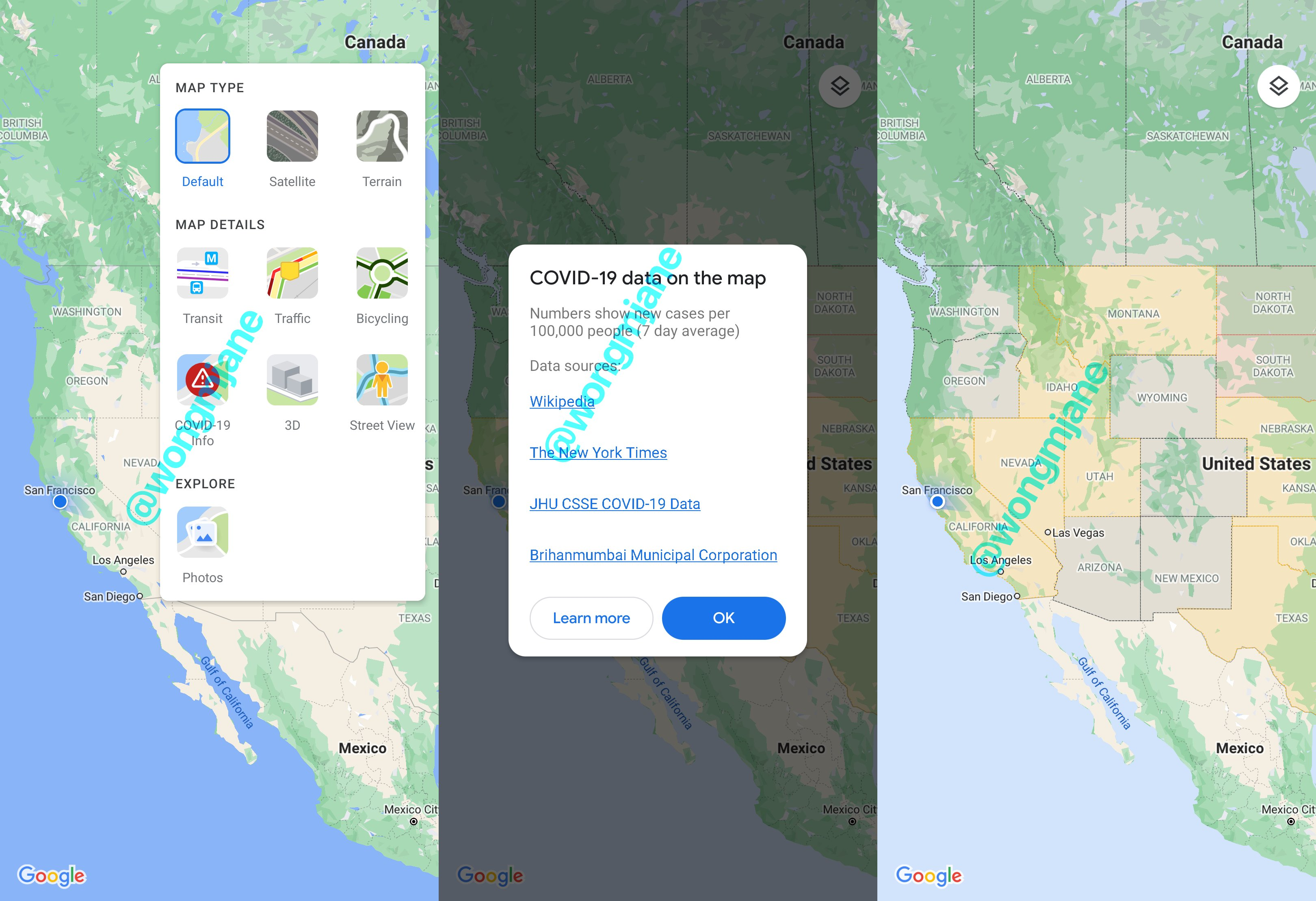
Google has been placing COVID-19 reminders, warnings, and information in many of its services for some time now. You can’t use a Google service without being reminded to wear a mask, or of where to go for screening. It’s even added various tips to Maps, including where to get takeout during the pandemic. With a possible new overlay feature, it looks like we might soon be able to add Google Maps to our list of COVID tracing apps.
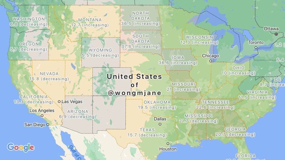
Jane Wong has shared screenshots she was able to trigger in Maps, showcasing the new feature. The pictures detail the COVID-19 tracking option alongside the other map overlays, like Traffic and Transit. The feature apparently sources data from Wikipedia, The New York Times, Johns Hopkins University, and Brihanmumbai Municipal Corporation. Using this information, the overlay colors impacted states, countries, and their borders. The map also displays whether the current numbers for each area are increasing or decreasing.