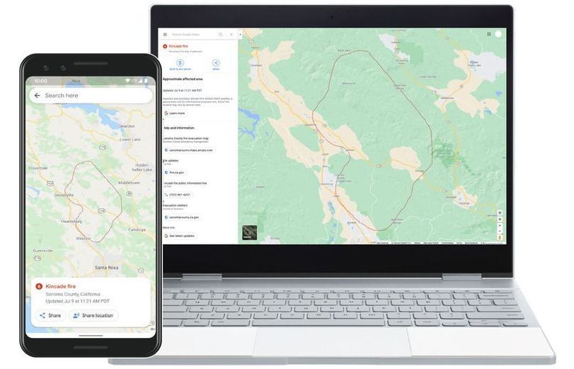
Google Maps will show wildfire boundaries in near real time
A new feature on Google search and Maps will give users near-real-time information on wildfires in the US. Data from NOAA satellites allows Google to update wildfire boundaries on its maps hourly.