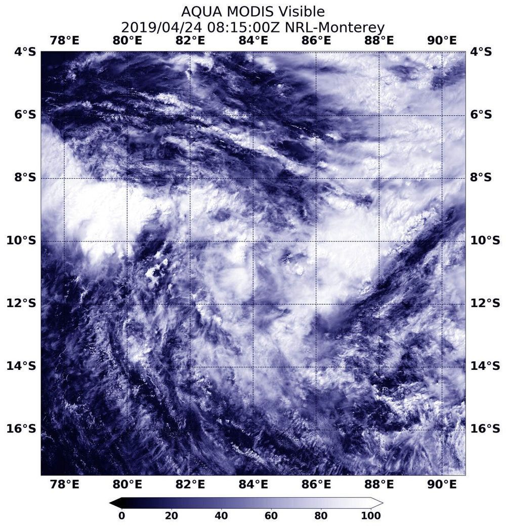
Visible satellite imagery from NASA’s Aqua satellite revealed the recently formed Tropical Storm Lorna was getting organized in the Southeastern Indian Ocean.
Lorna developed into a tropical storm on April 23 at 11 a.m. EDT (1500 UTC) and was named Tropical Cyclone 25S. On April 24, it received the name Lorna. At 4:15 a.m. EDT (0815 UTC) on April 24, the Moderate Resolution Imaging Spectroradiometer or MODIS instrument aboard Aqua captured a visible image of Lorna. The Joint Typhoon Warning Center or JTWC forecasters noted “persistent deep convection to the west of, and obscuring, the low level circulation center.”
By 11 a.m. EDT (1500 UTC) on April 24, Tropical Storm Lorna had maximum sustained winds near 40 knots (46 mph/74 kph). Lorna was centered near 10.9 degrees south latitude and 84.6 degrees east longitude, approximately 743 nautical miles southeast of Diego Garcia. Lorna has tracked to the east-southeast.