T he feeling of the ground shaking can be a scary experience. But have you ever wondered how or why earthquakes happen in the first place? According to National Geographic Society, earthquakes occur near tectonic plates boundaries, slabs of rocky crust that fit together to form the Earths outer shell. Plates, moving by mere inches annually, can grind, collide, separate, and scrape pass one another. Through these interactions, the more strains it builds results in vibrations, known as earthquakes. Some major plates are the Northern American and the Pacific Plate. Although earthquakes are watched closely, they are still hard to predict.
Did you know: In Fort Tejon California, north of LA, had a magnitude of 8.3 earthquake in 1857?
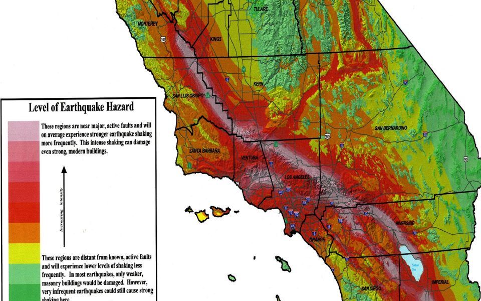
Come explore and learn more about earthquakes from these artistic maps that depict selected earthquakes in the U.S with a magnitude of 7.8 or greater, from 1897–1996, or a map that illustrates how moderate magnitude earthquakes can produce serious effects in Los Angeles, as well as a map that anticipates loss from future earthquakes. My favorite map is the colorful stress map that estimates the differential stress levels in the lithosphere, where earthquakes occur, and by researching the variations of unstable to stable frictional slips on faults can explain the occurrence of ductile earthquakes. Also available is a map that points out previous earthquakes that had generated tsunamis.