NASA scientists say that an asteroid that sped past Earth on Friday will get close enough to potentially collide with orbiting satellites in 2029.

In a paper for Nature this month, researchers claim the development of mega-constellations like Starlink “risks multiple tragedies of the commons, including tragedies to ground-based astronomy, Earth orbit, and Earth’s upper atmosphere.”
Perhaps the biggest effects could come as the satellites start to deorbit, sparking what could be a major experiment in geoengineering.
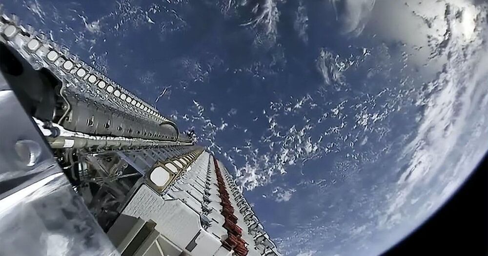
This week’s SpaceX launch is the 29th batch of Starlink satellites since the first in May 2019, building out the firm’s internet connectivity constellation. Starlink aims to offer high-speed and low latency internet access almost anywhere with a view of a ground terminal.
SpaceX has now launched 1737 satellites for Starlink, with 951 operational. Starlink satellites typically take a few months to move into position and start operations. Starlink is already the biggest single constellation in space, but the firm has applied for permission to launch up to 42000 satellites.
I could probably be described as a SpaceX enthusiast. I catch their launches when I can, and I’ve watched the development of Starship with great interest. But the side-effect of SpaceX’s reusable launch system is that getting to space has become a lot cheaper. Having excess launch capacity means that space projects that were previously infeasible become suddenly at least plausible. One of those is Starlink.
Starlink is SpaceX’s satellite Internet service. Wireless and cellular internet have helped in some places, but if you really live out in the sticks, satellite internet is your only option. And while satellite Internet isn’t exactly new, Starlink is a bit different. Hughesnet, another provider, has a handful of satellites in geostationary orbit, which is about 22000 miles above the earth. To quote Grace Hopper, holding a nearly foot-long length of wire representing a nanosecond, “Between here and the satellite, there are a very large number nanoseconds.”
SpaceX opted to do something a bit different. In what seemed like an insane pipe dream at the time, they planned to launch a satellite constellation of 12000 birds, some of them flying as low as 214 mile altitude. The downside of flying so low is that they won’t stay in orbit as long, but SpaceX is launching them significantly faster than they’re coming down. So far, nearly 1600 Starlink satellites are in orbit, in a criss-crossing pattern at 342 miles (550 km) up.
WASHINGTON — The Tyvak-0130 rideshare payload that flew to orbit May 15 on a SpaceX Falcon 9 carries a miniature space telescope for possible commercial use.
The technology was developed by Tyvak Nano-Satellite Systems and the Lawrence Livermore National Laboratory under a four-year agreement to advance compact telescopes for commercial applications, Tyvak’s CEO Christian “Boris” Becker said in an interview with SpaceNews.
Becker, a retired U.S. Navy rear admiral, was recently named chief executive of Tyvak, a satellite manufacturer in Irvine, California, owned by Terran Orbital.
Liftoff is at 1:42 p.m. EDT (1742 GMT).
CAPE CANAVERAL, Fla. — United Launch Alliance (ULA) will launch an Atlas V rocket into space today (May 17), and you can watch the action live online.
The two-stage rocket will blast off from Space Launch Complex 41 here at Cape Canaveral Space Force Station in Florida at 1:42 p.m. EDT (1742 GMT), carrying with it a missile-warning satellite for the U.S. Space Force. The launch was initially aimed to launch 7 minutes earlier, but ULA pushed it back “to avoid launching too close to object already in space,” company officials said in an update on Twitter.
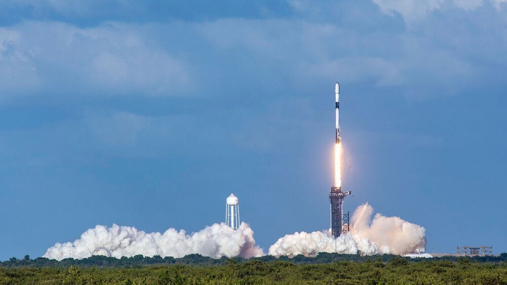
A Falcon 9 rocket and 60 more Starlink internet satellites set for launch early Sunday at Cape Canaveral will mark the first time SpaceX has flown a first stage 10 times, reaching a milestone that the company once said could be a limit for reusing boosters. Now SpaceX plans to keep flying reused rockets on Starlink missions until one fails.
The mission Sunday is set for liftoff at 2:42 a.m. EDT (0642 GMT) from pad 40 at Cape Canaveral Space Force Station, Florida. Nine kerosene-burning Merlin 1D engines will power the Falcon 9 rocket northeast from Florida’s Space Coast, following a trail blazed by 26 previous dedicated Starlink missions.
There is an 80 percent chance of good weather for launch at Cape Canaveral, according to the 45th Weather Squadron at Patrick Space Force Base. There is also a good chance of favorable upper level winds and acceptable conditions in the Falcon 9 booster’s downrange recovery area in the Atlantic Ocean.
Virgin Orbit, the sister company of Virgin Galactic, is gearing up for its next space launch in June when it will put six satellites in orbit.
The mission, named “Tubular Bells, Part One” after the first album Virgin Records released in 1973, will launch satellites for the U.S. Department of Defense, Poland’s SatRevolution and the Royal Netherlands Air Force.
A modified Boeing 747–400 jet will carry the LauncherOne rocket to high altitude, then release the 70-foot, 57000-pound rocket into the air.
DARPA awarded Northrop Grumman a $13.3 million contract to provide positioning, navigation and timing (PNT) payloads for the Blackjack program.
WASHINGTON — The Defense Advanced Research Projects Agency awarded Northrop Grumman a $13.3 million contract to provide positioning, navigation and timing (PNT) payloads for the Blackjack program.
Blackjack is a DARPA project to demonstrate the military utility of small satellites in low Earth orbit to provide communications, missile warning and PNT. Northrop Grumman’s contract was awarded April 28, according to sam.gov.
The company will supply two payloads that broadcast a new signal that is not dependent on the Global Positioning System.
