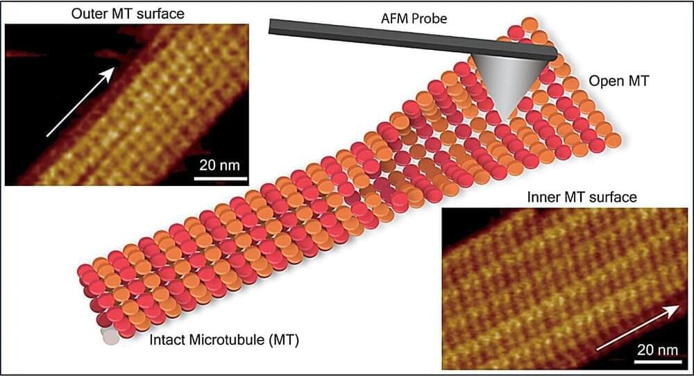
Toggle light / dark theme

Indian Tectonic Plate Is Splitting in Two Beneath Tibet, Latest Analysis Finds

The engines driving the growth of the world’s highest mountains into the sky run deep beneath the planet’s skin. Geologists have some idea of the mechanisms at work, but evidence has so far left plenty of room for debate over the details.

Combined with a fresh look at previous research, a recent analysis of new seismic data collected from across southern Tibet has delivered a surprising depiction of the titanic forces operating below the Himalayas.

Presenting at the American Geophysical Union conference in San Francisco last December, researchers from institutions in the US and China described a disintegration of the Indian continental plate as it grinds along the basement of the Eurasian tectonic plate that sits atop it.

Seismic Shifts: USGS Unveils Groundbreaking Earthquake Hazard Map

The research-based map is the first to display an updated, comprehensive National Seismic Hazard Model for all 50 states.

Nearly 75 percent of the U.S. could experience damaging earthquake shaking, according to a recent U.S. Geological Survey-led team of 50+ scientists and engineers.

This was one of several key findings from the latest USGS National Seismic Hazard Model (NSHM). The model was used to create a color-coded map that pinpoints where damaging earthquakes are most likely to occur based on insights from seismic studies, historical geologic data, and the latest data-collection technologies.

The Big Chill: America’s “Dangerously Cold” Arctic Awakening

Dangerously cold temperatures lingered over large swaths of the country for several days in mid-January 2024.

A large mass of Arctic air spilled south from Canada and lingered for several days over much of the contiguous United States in mid-January 2024. The system brought a wintry mix of bitterly cold temperatures, freezing rain, and snow that extended from the Pacific Northwest all the way to the East Coast.

As the airmass came south, sub-zero air temperatures settled over Montana and the Dakotas on January 13 and 14. Air temperatures at a National Weather Service station in Billings, Montana, reached-30 degrees Fahrenheit (−34 degrees Celsius) on January 13, the lowest temperature recorded there since the site was established in 1999.