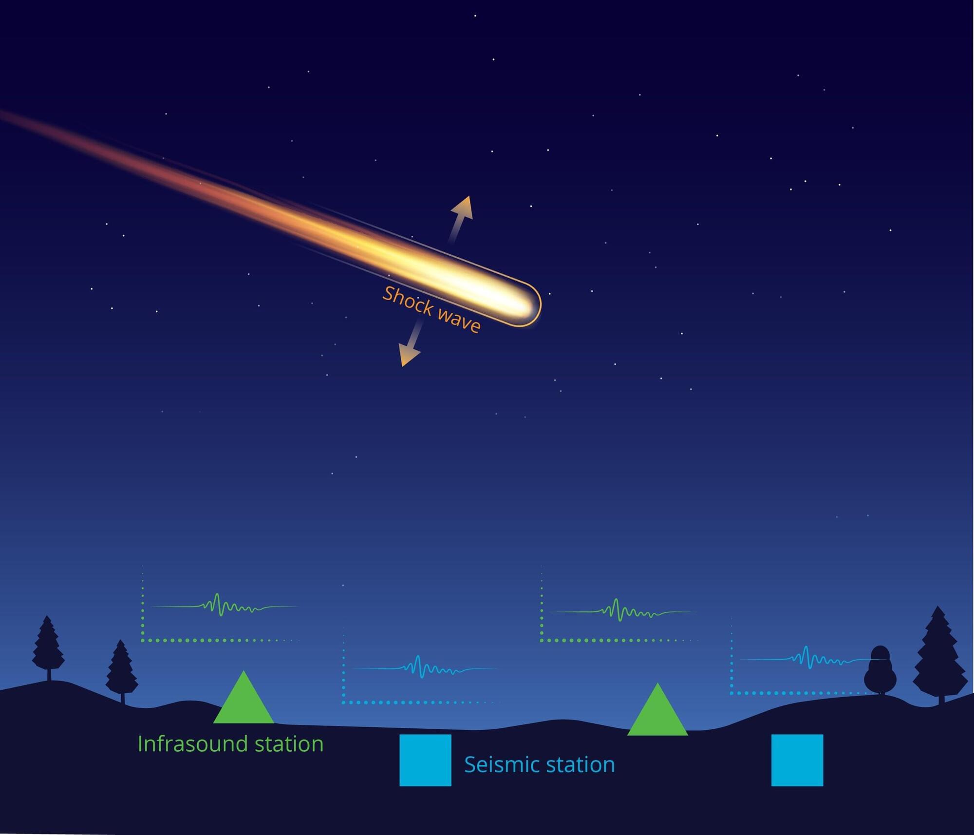
When a bright fireball streaked across the Alaska sky last spring, the usual tools scientists rely on to track such events—cameras and satellites—did not provide a detailed picture. But the meteoroid left behind something else: low-frequency sound waves that traveled hundreds of miles and were captured by a dense network of earthquake and volcano-monitoring sensors on the ground.
Using those signals, a Sandia National Laboratories-led team of researchers, students and citizen scientists reconstructed the object’s path through the atmosphere, where it broke apart and where debris likely fell.
In a study published in the Journal of Geophysical Research: Planets, the team showed how low-frequency sound waves, faint ground vibrations, weather radar data and publicly shared videos can be combined to reconstruct a fireball’s path even when optical coverage is sparse or incomplete.
You’ve given me a lot to think about.